Des Lehndorf – a long walk to save the Kiwi

Friends of Flora is a group of dedicated volunteers who maintain and check over 600 stoat traps in the rugged Mt Arthur area of the Kahurangi National Park.
They have already been successful in reducing the number of stoats and other predators down to a level so that whio (Blue Duck) have been reintroduced into the area, and are now re-established. They now have DOC permission to relocate 7 pairs of roroa (Great Spotted Kiwi) in the autumn of 2010.
The initial cost to carry this out is $24,000, and then up to $72,000 over the next 3 years. This is to cover the cost of locating the 7 adult pairs with specially trained dogs, relocation by helicopter to the Mt Arthur region, radio transmitters and ongoing tracking and checking of their movements etc. Most of this will be done by dedicated volunteers under the supervision of DOC staff.
Having spent a lot of time in this very special part of NZ, this is something that is very dear to my heart. So I am about to set out on a 1250km trek down the entire length of the South Island to raise as many funds as I possibly can to help this project succeed (see attached map).
I will fund all the expenses of this trip myself, but I am asking as many people as I can to pledge a donation to this project on the completion of my walk. If you can pledge1, 2, 5, 10, 20, 50 (or more) cents per kilometre for my trek it will go a long way to making this a success.
I CAN ASSURE YOU, THAT 100% OF ALL DONATIONS WILL BE USED ENTIRELY FOR THIS PROJECT.
Sure, many of you may never get into this part of the country, but your children or grandchildren might. Take it from one who knows, there is nothing more magic than to be under the stars in the mountains at night and to hear the call of our national icon.
Please, give what ever you can and help this happen. I can supply more detailed info on this proposed project and on the aims and plans of Friends of Flora if required (www.fof.org.nz).
Many thanks for taking the time to read this - Des Lehndorf

1250 kms
5 national parks
9 moutain passes to traverse
11 lakes to walk around or paddle across
14 major rivers to follow or cross.

I have split the trek up into 10 stages ranging from 4 to 12 days.
The whole journey should take me about 100 days.
If you want to join me on any of these stages, you would be more than welcome. I would love the company and you could enjoy some of the best tramping in the world! The route varies between easy walking on some of NZ’s great walking tracks, to route finding across mountain ranges. If interested contact me for further details, dates etc.Index
Weekly Update 1 - 09/10/2009
Weekly Update 2 - 20/10/2009
Weekly Update 3 - 27/10/2009
Weekly Update 4 - 10/11/2009
Weekly Update 5 - 17/11/2009
Weekly Update 6 - 27/11/2009
Weekly Update 7 - 10/12/2009
Weekly Update 8 - 17/12/2009
Weekly Update 9 - 02/01/2010
Weekly Update 10 - 11/01/10
Weekly Update 11 - 21/01/10
Weekly Update 12 - 31/01/10
Weekly Update 13 - 08/02/10
Weekly Update 14 - 12/02/10
Weekly Update 15 - 20/02/10
Weekly Update 16 - 25/02/10
Weekly Update 17 - 02/03/10
Weekly Update 18 - 09/03/10
Weekly Update 19 - 18/03/10
Weekly Update 20 - 20/03/10
Weekly Update 21 - 22/03/10
Weekly Update 22 - 26/03/10
Weekly Update 23 - 12/04/10
Weekly Update 24 - 14/05/10
Weekly Update 25 - 01/06/10
Weekly Update No. 1 - Friday 09/10/2009 - 90 days to off !!!
Firstly, thank you all so very much for the donations and pledges you have all made to help this very worthwhile project happen. I will update this site every week just to keep in touch with you all and let you know how things are going. I think the most common Question I have been asked since I decided to undertake this trek is…Why? I still wake up in the middle of the night and ask myself the same question!
A colleague and I planned on doing a South Island yomp 30 years ago when we were both working for the Fiordland National Park, but circumstances changed and it never eventuated. Over the years I have often wondered what a challenge a trip such as this would be like, but again, other things popped up and that’s as far as it got. Earlier this year, Marilyn and I were in France visiting friends and Andy (friend) casually mentioned that he was going to do a solo sailing trip from Plymouth (UK) to New York (USA) AND back.
"You’re mad," says me "why on earth do you want to do something like that?" His reply was simply "It’s something I’ve always wanted to do and if I don’t do it now I never will and I’ll always wonder what it would have been like." What better reason could he possibly have? How often do we all look back over our lives and say "If only I…"or "I wish I had…" So that was that really. That evening I said to Marilyn I might head off next summer and do something I’ve always wanted to do. "Well, I don’t think you should wait another 30 years to do it" was the answer.
Since then, she has put as much time and effort into this as I have and is responsible for most of the fund raising to date. I certainly wouldn’t be at the stage with my plans I am now without her. God bless her!
On our return to NZ, I heard that Friends of Flora were starting a drive to raise funds for the re-establishment of the Great Spotted Kiwi into the Mt Arthur region of the Kahurangi National Park. This is a dedicated group of people I have had the privilege of being associated with over the past couple of years and thought I could kill 2 birds with 1 stone. (Actually, that’s probably not the best term to use). Fulfilling a dream of mine and raising funds for a cause I so believe in.
I have had an immense amount of pleasure out of New Zealand’s great outdoors over the years and anything I can do to help preserve our native flora and fauna for future generations I will. So, there it is, my first chapter of what I hope will be a great adventure for me and a profitable one for the Great Spotted!
Pledges & donations to date: $3,022
"Life is what passes you by when you are busy doing other things" (John Lennon)
Weekly Update No.2 - Tuesday 20/10/09 - 79 days to off!
Hi one and all. Trust all is going well for everyone. Hope the weather at the moment is not a sign of things to come! Even down here in sunny Nelson, we have had more wet days than fine over the past couple of weeks. Bit like an English summer actually.
Anyway, I thought this week I would outline the route I plan on taking. This, of course is subject to change at any time if the weather or one of a thousand other things don’t co-operate.
I have a couple of other routes worked out, but this is the one I hope I can take. As you can see, it covers every type of country we have here in NZ. High mountain passes to coastal beaches.

I will outline each Northern section briefly today and do the Southern parts next week.
Section 1: Collingwood to Owens River through the Kahurangi National Park. This includes a 20 km road walk from Collingwood to the start of the Heaphy track through to Karamea. From there, across the Wangapeka track, over Mt Owen and through to Owens River and into Murchison for a couple of days break. This should be a fairly easy start to the trek, with only the crossing of Mt Owen being off any regular track.
Section 2: Lake Rotoroa to Lewis Pass through the Nelson Lakes National Park. From an easy start to what I think will be the most difficult part of the trip. Down the side of the lake, along the Sabine River and up over the infamous Waiau Pass. If you want a detailed description of this wee gem go to http://www.nelsonlakesshuttles.co.nz/the_waiau_pass.htm If I manage to stagger over the top and down the other side, I join up with the well known St James Walkway. I will have what I imagine will be a couple of well earned days off in Hanmer Springs.
Section 3: Lewis Pass to Otira (Arthurs Pass National Park). This follows a fairly well beaten path over the Harpers Pass, which, in days gone by, was touted as a possible rival to the world famous Milford Track. The highlight of this section will undoubtedly be the hot springs halfway along the way! The only problem on this leg is the Arthurs Pass end where 3 major rivers have to be crossed and it has been known to rain somewhat heavily on the odd occasion in that part of the world. Still, will have a good book with me and an extra day or two of food so will just sit in a hut till the level drops.
Section 4: Arthurs Pass to Lake Coleridge. This is the shortest leg of the journey. A 3 day walk over the Lagoon Saddle and down the Harper River to the shores of Lake Coleridge.
I will detail the next 6 sections next week.
Take care and keep smiling.
Pledges & donations to date: $3,620
‘Tis better to remain silent and be thought a fool than to speak and remove all doubt'. (Mark Twain)
Weekly Update No.3 - Tuesday 27/10/09 - 72 days to off!
Just to pick up from last weeks chapter on the favoured route. We got down to Lake Coleridge, which is the last of the National Parks I will pass through for a while. From here on down to the Mt. Aspiring National Park, I am pretty much crossing over the spectacular southern high country, including a fair bit on private property.
Section 5 Lake Coleridge to Rangitata River This section involves a fair bit of road walking on back country metal roads. If the Rakaia River (pictured on left), is low enough to walk across it will save me about 2 days walking. If I can’t get across the river at Lake Coleridge, I have to hoof it about 20 K’s to the bridge and then backtrack up the other side. As you can see by the pic, it is a fairly decent bit of water. The next interesting highlight of this leg is the Rangitata River, pictured on the right.


The only reasonably safe place to ford this river is way up in the headwaters where the riverbed 4 Km’s wide! I hope to spend a night or two at Mesopotamia station on the south side of the river before setting off on the next leg
Section 6 Rangitata to Twizel. From the banks of the Rangitata, it’s off over the Two Thumbs Range to the shores of Lake Tekapo. I am really looking forward to this leg, as it looks really interesting country and the views from the tops should be fantastic, weather permitting. It is also supposed to be a good part of the country to see chamois and thar.

From Lake Tekapo it’s across the fascinating McKenzie Country to good ole Twizel. Hopefully I will have the glorious back drop of Mt Cook and Lake Pukaki to gaze upon on. (pictured above). Not bad eh ??
Section 7 Twizel to Wanaka Leaving Mckenzie Country at Twizel, it’s across to Lake Ohau and then up the Ahuriri River, into the Ahuriri Conservation Park and then across to Lake Hawea and Lake Wanaka. Now there’s a place that has changed a bit over the past 20 odd years! Still a very pretty spot with all the mod cons. I imagine I will be due for a bit of civilization by then !
Section 8 Wanaka to Glenorchy. Back into National Parks again. This time Mt. Aspiring. This is starting to get back into familiar territory for me. I did a lot of hiking through this area some years ago. I am sure that over the past years there has been a lot of Teutonic Plate movement and the hills will be a lot steeper!
This section takes me up the Matukituki Valley to the lovely Mt Aspiring hut, over the Cascade Saddle and down the Dart River to Glenorchy. Definitely one of my favourite places in NZ.


P.S. the last time I crossed this bridge, the bottom wire was under water !!!
Section 9 Glenorchy to Te Anau Definitely familiar country now. We leave Mt Aspiring National park at the Routeburn Saddle on the Routeburn Track and enter Fiordland National Park, NZ’s largest. (About 1.4 million hectares I think) I worked as a hut warden on the Routeburn in a previous life and, boy, what a job, but that’s another story. The bush here is typical NZ rain forest, as pictured. You get this sort of growth when you get around 7 meters of rain a year !
A left turn off the Routeburn at Lake Howden and down the Greenstone Valley to the Mavora Lakes and through to Te Anau. Lived here while working for the Fiordland National Park. Before DOC came into being (about 1986 I think) each NZ National Park was controlled by a local board under the umbrella of the Lands and Survey Department.
Section 10 Te Anau to Te Waewae Bay. A paddle across Lake Manapouri and into the real heart of Fiordland. Down the infamous Dusky Track to Loch Maree (yes, Loch, the Scottish influence of Southland rearing it’s head). This really is a classic to finish up on. Last time I did this track we had to battle through armpit deep water with our packs on our heads !! Real character building stuff!! Yeah right!!. From Loch Maree to Lake Roe and down to Lake Hauroko (NZ’s deepest lake). From Hauroko it is a 2 day walk over the Hump Ridge to Te Waewae Bay and THE END.
This should be about 100 days since leaving Golden Bay on the South Islands north coast.
So, there it is from end to end. Don’t forget, I would love to have company on all or part of this adventure, so get in touch with me if you want to see the best New Zealand can offer.
Have a great week and will drop another missive soon.
TOTAL DONATIONS $4060 AND STILL GROWING - THANK YOU ALL SO MUCH.
"The surest sign that intelligent life exists elsewhere in the universe is that none of it has tried to contact us" (Galvin)
Weekly Update No.4 - Tuesday 10/11/09 - 59 days to off!
This is the chap the walk is all about. The Great Spotted Kiwi/ Roroa or, for the really clever people, the Apteryz haastii.
It is the largest of NZ’s 5 species of kiwis, but there is less known about this species than any of the others. This is mainly due to their isolated habitats in some of the most inaccessable backcountry of NZ. This is one of the main reasons it is so important to get a population of these birds established in an area that is a bit more accessable and enable a closer study of them.
In pre–European days, the population of these birds is estimated at about 12 MILLION !! Now, it is guessed at between 15 to 22 thousand!! Haven’t we done well?

At present it is estimated that the population is decreasing at the rate of about 2% per year. So one doesn’t have to be an expert to work out that unless something is done pretty soon this poor chap will join the long list of other bird species that have gone forever.
The early maoris hunted the Roroa for food and feathers, which were prized for cloak making. The effect on the kiwi’s at this stage, was minimal. Plenty of birds and not a lot of people. I came across this sketch of an early maori using a dog to hunt the birds.

I don’t know how accurate this is. I imagine they must have been fairly easy game to hunt. Then, along the europeans with all that came with them - the rats, cats, dogs etc. Couple this with large scale land clearing, huge areas of native forest cut down for timber and allsorts of mining with all the accompaning damage, the survivng birds beat a hasty retreat into the backblocks. But the best was yet to come! To combat the rabbit population explosion, some bright spark thought it would be a good idea to bring in a few stoats, weasels and ferrets to control them. It didn’t take long for these killing machines to develop a taste for kiwis (and all the other flightless native birds). Within a very short period of time all the kiwi species had been decimated. The kiwi has a very distinct musky smell and is very easily sniffed out by its predators. Later on, along the possum. I have seen photos of these sods eating both birds eggs and chicks. Even today, in the areas were there is no predator control, the mortality rate among birds under the age of 12 months is a HUGE 95% !! In areas were there is some control, this drops down to 40%.
The adult Roroa is a very aggressive bird and will put most of the predators to flight. The exception to this is dogs. As I said earlier, the kiwi has a very musky smell and dogs find it irresistable. In the north of the North Island, there was one case of a single family pet dog being responsible for an estimated 500 kiwi deaths over a 12 month period
Unfortunatley, the chick is abandonded by it’s parents as soon as it hatches, so is incredibly vunerable for the first year of its life.
The females of this species can gow up to 50 cm tall and weigh up to 3.3 kgs. The male is slightly smaller, reaching 45cm and 2.6 kg. A pair of these birds will occupy a terriorty of up to 25 hectares and will defend it fiercely. They are of course nocturnal, but from all accounts, in pre european days, used to feed during the day as well.
Next week I will fill you in on some of what is involved in the live capture and relocation of these chaps.
ON A MUCH LIGHTER NOTE !!!!

I had a couple of visitors the other day. Believe it or not, a couple of Spotted Kiwis!! They had heard about my pending trek and wanted to know if I would like some company . What better companions could I wish for. They will supply their own food, should be able to find a track and not talk too much. After explaining some of the difficulties we might encounter on the trek, it was decided that only one of them would come with me. The other one decided he/she was more of a homebody and enjoyed the creature comforts too much.
The other problem we have is neither of these two have names, so, after much discussion, we have decided to ask all our donors and sponsors for a name for the smaller one who will come with me.
The larger one has offered itself as a prize to the winner!
So, lets get a name for my mate and the other one goes to whoever comes up with the best name
Due to the fact I know most of our donors and sponsors, I have asked Peter and Clare (2 very active FOF members) to be the judges.
So, email your suggestions to desandmarilyn@xtra.co.nz before the 22nd of November and I will dispatch the prize off the following week. Take care and stay happy.

DONATIONS TO DATE $4360
THE BIGGEST RISK IN LIFE IS NOT TAKING ONE
p.s. These wee stuffed toys are made by NativeZ and are really quite cute.
Weekly Update No.5 - Tuesday 17/11/09 - 52 days to off!
To carry on from last week, I will explain in brief about the procedure to relocate the Great Spotted. It is a pretty involved carry on and a fair amount of luck is hoped for. Naturally, the first thing is find an area where the wild population is such, that, removing a few is not going to have too much of an effect... In our particular case, it has been decided to concentrate on already established pairs, as this will, hopefully, mean they will bred a lot earlier than if we brought in single birds. In past experience’s relocating single birds has meant a long delay in any eggs being laid while they sort out partners and territories. Once an area has been selected, one or two contractors (usually with DOC assistance) and their specially trained dogs move in and start hunting. This usually happens between February and May.

Once one member of an established pair has been caught, every effort is made to catch its mate on the same night. A blood sample is taken, a small transmitter is fitted and the birds are released. Once the blood samples have been tested and given the all clear, the birds are relocated via the transmitter and put into specially designed bags, taken back to the main camp and placed into wooden crates. They are kept in these for an absolute maximum of 48 hours and are fed worms, which is both a food and water supply. Once a number have been relocated and crated, they will be flown by helicopter to the predetermined release sites. Each of these sites will have a burrow, either a natural cavity or an artificial one. This means the birds are going "from the wild to the wild". The burrows will have a cover over the entrance until after sunset, at which time the covers will be removed. This covers are to stop the birds rushing out as soon as they have been put into the burrows and becoming disorientated in daylight hours.

Each bird is fitted with an "egg timer" transmitter and for the first 3 months after its release each bird will be located every 3 weeks and its position recorded. This will continue for 12 months after release. During the first year, following the release of a bird, if after 3 months, a bird cannot be located in the area, a search will be carried out by air. If the bird is located outside the area designated as the "safe zone" every attempt will be made to recapture the critter and bring it back to the release area. If the same bird does a runner again then a decision then has to be made by the powers that be what to do. This could possibly result in the bird being taken back to the original source area.

So that’s it in a nutshell really. As you can see, this involves a HUGE amount of man hours, both during the capture and after the release. Couple this with the cost of helicopter transfer (which aren’t cheap!) and the transmitters and you can see why the amount to carry this out is so much. BUT, WE WILL GET THERE!!!! And it will be worth every cent.
After all, it is OUR bird.Catch up again next week. Take care.
WHERE ARE ALL THE KIWI NAMES????? THESE 2 CHAPS/CHAPESSES ARE SUFFERING REAL IDENTITY PROBLEMS NOT HAVING NAMES. COME ON, I’M SURE THERE ARE SOME GREAT IDEAS OUT THERE.
Donations to date $4422.
VEGETARIAN IS AN OLD APACHE WORD FOR LOUSY HUNTER
Weekly Update No.6 - Friday 27/11/09 - 42 days to off!
Thought this week I would explain the planning and logistics that has to go into something this crazy. As I said in my first update I decided to do this back in July this year. We were in France at the time, so other than a lot of talking about it with Marilyn, I couldn’t actually do a lot, which was a bit frustrating to say the least. We arrived back in NZ on the 1st September and as I had to be down here, (Motueka) early October, it didn’t give me a lot of time to put everything together. Believe me, there is a helluva lot of threads to tie up. Naturally, the first thing was to work out a route. A couple of years ago I had installed into my computer mapping software called Memory Map and, boy, has it proved invaluable!!! It has every map of NZ on it including the topographical 1:50,000, maps, which meant I could start at the top of the South Island and work out what I thought was the most interesting and straight forward route. The other thing I found a huge help was the Te Araroa Pathway web-site. This is a group of wonderful dedicated people (volunteers of course !!) that have, over the past few years, worked out a walking route from Cape Reinga to Bluff. They have done this by taking existing routes and tracks and either creating new links between them or suggesting the best way to get from one track end to the beginning of the next. Check out their web site on www.teararoa.org.nz

I will follow their basic suggested route from the Nelson Lakes National Park through to Lake Wanaka, with a few plans of my own thrown in. for good measure. Having worked out a route, I then had to work out a number of alternatives in case of bad weather etc.
The other web site I have used over and over is the Department of Conservation.
(Imagine what the early explorers and pioneers would think of all this Hi-Tec stuff nowadays !!!) The DoC site is great, it has virtually every track and route on it, with all the info on huts etc. Again, if you plan on heading out into the great outdoors have a look at it . www.doc.govt.nz and just follow the links. While on the subject of DoC, I have had a fair bit to do with the local DoC office here in Motueka over the past couple of months and they couldn’t be more helpful or obliging and all bloody nice people as well !

Once the route was decided upon, I then had to find addresses I could forward my "bounce box" onto and where I could bludge a shower and a washing machine between each stage. My "bounce box" will have a spare pair of boots, spare tent, some basic non-perishable foodstuffs and a set of flash clothes for going to town in! This has resulted in a number of strangers offering me overnight accommodation in all sorts of places. Once again, it proves that there really are a lot of kind and helpful people out there. Pity we only ever hear about the bad buggers! After sussing all this out, I had to decide on what gear and equipment to organize. Basically, I had to be completely self-sufficient for at least 2 days longer than each stage. I.e. on a track for 6 days = 8 days supplies. Actually I think I will leave the equipment side of things for another time, as it is pretty involved.
No update next week, people, as I am off on a week’s trip to an old isolated lighthouse on the West Coast called Kahurangi Point. No longer functioning and now maintained by DoC. From all accounts, a beautiful and rugged part of the world. I will take along all my gear I have for the trek and make sure it works.

Take care and stay happy.
DONATIONS TO DATE $4592 !!
TRAVEL IS FATAL TO PREJUDICE, BIGOTRY AND NARROW MINDEDNESS (Mark Twain)
AND NOW, WHAT YOU HAVE ALL BEEN WAITING FOR !!! (YEAH RIGHT)...FINALLY, A NAME FOR MY TRAVELLING MATE (WHO IS GETTING OUTFITTED IN A VERY UPMARKET BOUTIQUE AS WE SPEAK)
IT IS …………Tiri te Kiwi
Weekly Update No.7 - Friday 10/12/09 - 27 days to off (Yikes!)
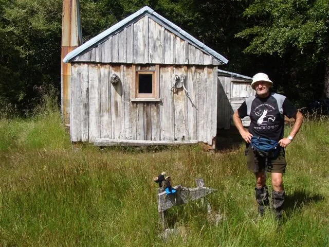
A slight tack away from the build up to the trek this time. As I said in the last update I spent last week down on the South Island west coast at Kahurangi Point. An old lighthouse built in 1903 and still going strong but now fully automated. (Has been since 1960-something).

This place is one of NZ’s best kept secrets! Access is pretty difficult which, personally, I think is just as well. I went down there as a guest of "Bush and Beyond", a guiding company which does guided walks throughout the Kahurangi National Park. It is owned by Bill and Maryanne who have run it for the past 16 years. They are also the founding members of Friends of Flora. Their knowledge of the National Park, its history and its flora and fauna is second to none.I think they have forgotten more than most people know. They are true conservationists and are passionate about what they do. Couple all this with great senses of humour and you are guaranteed to have a fantastic trip. Check out their website www.bushandbeyond.co.nz/

Anyway, back to the trip. We drove down as far as the road end at the Anatori River, crossed the river and started walking down the beach. This walk has to be timed around the tide as both ends have rather large rivers to cross. The weather was fantastic, bright and sunny, but just as we started off the wind started blowing from the south, right in our faces. As the day went on, so the wind got stronger, reaching gusts of 35-40 knots per hour. It really was an effort to push into it. I was so grateful to have a pair of walking poles with me. The last river we had to cross was aptly named Big River and can only be forded at dead low tide. Even then it is still waist deep! Bill and Maryanne have, in the past, been over chest deep getting across.

Fortunately there is very little current so other than a wet bum it’s no problem. The walk from the Anatori River to the "hut" takes about 4 hours. The "hut" is actually the old lighthouse keepers house and is one of the flashest places I have ever stayed in in the bush. It has a wonderful old coal range with a wetback, which means unlimited hot water. Best off all, it has a bath which got very well used.

The surrounding bush is really lovely. There has been an intense pest eradication program in the area over the past few years and the regeneration is so noticeable. The Northern Rata was starting to flower and the hillsides were a blaze of crimson. There has also been a huge increase in the bird populations, with wekas, pigeons, tuis, bellbirds and now the great spotted kiwi has been heard again at night! 1080 kills all the birds!! Yeah right!! We did a day walk out to the lighthouse and further down the beach to the Kahurangi River which has quite an impressive waterfall 5 minutes up stream from the beach which is well worth the effort. This portion of the beach is favoured by several NZ fur seals, which makes for an interesting walk.

They are mainly young bulls who have been chased off by the bigger males and aren’t too keen on sharing their patch at all and can look and sound pretty savage when they want to! At low tide there are some wonderful rock pools to poke around in. It was in one of these I saw the biggest starfish I have ever seen, it measured at least ½ a metre across from a tip to tip. Also lots of mussels there for the taking. We spent 3 nights down there and considering it was the west coast, the weather was pretty good, only rained for half the time.

Was a great test for my new tent, which past with flying colours!! The walk back to the Anatori was the opposite to the walk down. It was very still and warm. A thick sea fog rolled in which gave the place a very eerie feeling. Visibility dropped to a few meters and if we couldn’t have heard the surf breaking on our left, we would have had to have walked following a compass bearing!
A truly magic place and, as some chappie said once before", I will return!!
You’re never too old to have a happy childhood
DONATIONS TO DATE $4692
Weekly Update No.8 - Friday 17/12/09 - 21 days to off!
Not much this week, have been toiling away and making all the last minute arrangements. But, some really fantastic news! Friends of Flora now have the official go ahead to re-locate our 7 pairs of Great Spotted Kiwis! Fof has now raised the $24,000 (including our $5000+) to cover the initial cost of the location, capture and relocation of the birds late March 2010. The area the birds are coming from has been finalized and the dogs and handlers booked. So it IS going to happen!! Each and every one of you are responsible for this I personally thank you all very much. (Mind you, I have to finish the walk yet.) This is the last you will hear from me in 2009. I head back to Auckland next week to spend Christmas with my family and will come back to Nelson on the 5th of January 2010. I think I have everything covered, but, like all the best laid plans of mice and men………. So the only other thing to do now is to wish you and yours all a very merry Christmas and I hope 2010 brings you all that you want it to. Have a wonderful break and I will be in touch before I head off.

Take care and stay happy.
DONATIONS $5192
Weekly Update No.9 - Friday 02/01/10 - 5 days to off!
I hope the Christmas and New Year break has been all you hoped it would be and the weather has been co-operative. I have spent a wonderful couple of weeks back near Auckland enjoying the company of my family and catching up with friends. All Christmas should be !
I went for a 4 hour walk the other day in the Waitakere Ranges, west of Auckland. A fantastic place, right on the doorstep of NZ’s biggest city. We walked along the first section of what is going to be the Hillary Walkway which will be a 3 -4 day trek along the length of the ranges passing by some of the wild west coast beaches. This area is under the Auckland Regional Council control and they have done a fantastic job up there with a great track complex and some really lovely picnic areas and amenities. The thing that really impressed me was the number of families there enjoying the bush. (I could be cynical and say that maybe that was because all the shopping malls were closed!) Back in the early 1900’s, the Auckland City Fathers of the time had the foresight to halt all the logging in the ranges and designate it a reserve. Thank goodness that even back then, there were people who put other things ahead of profit!

Some of the Kauri trees up there are HUGE and if logging had been allowed to continue, the whole place would be covered in scrub and very little else. The most outstanding thing though, was the number of juvenile kauris coming through. Literally hundreds and hundreds of trees in the 20-50 year old range. Sadly, there is a fungal disease (Phytophthora sp.) going through the forest at the moment which is affecting kauri trees of all sizes. This disease is closely related to the blight that wiped out the Irish potato crop in the mid 19th century. It is spread by contact from one tree to the other by people walking over the roots and also by the wild pigs that roam the area. Hopefully a cure will be found for this damn thing in the near future.

There is an area of the Waitakeres that, like the Flora area of the Kahurangi Park, has been extensively trapped and maintained by a wonderful group of volunteers over the past 10 years or so. This area, known as the Ark in the Park is easily accessible and has a very easy 1 hour walk through it. I had the privilege a couple of years ago of being involved with the Ark vollies in capturing some 50 odd Hihi (stitch bird) on Tiritiri Matangi Island and releasing them in the Ark. They have also reintroduced North Island Robin, Whitehead, Tomtits and recently some Kokako, all of which seem to have settled into the area. Once again, thank God for volunteers !!
Anyways, onto the task in hand. Hopefully the next update you get will be from Karamea in about 10-11 days time. Hard to believe it was almost 6 months ago I decided to do this. To be honest, all I really want to do is get started now. I think I have done all that needs doing (famous last words!) and all that remains now is to do it. The hardest thing I think I am going to have to do is just take the walk one day at a time, as I have spent the past few months looking at the thing as a whole and now it will become a day by day thing.
As you can see, Tiri is all geared up and ready to go as well

I can promise you all that I will give it my best shot and just hope the body doesn’t let me down.
One last bit of good news. We have had an amazing number of new sponsors and donors over the Christmas break and the new total is now $6428.50
Thank you all again !
OK folks, that’s it. Enough of the talking, on with the walking.
A journey of a thousand miles begins with a single step
Weekly Update No.10 - Friday 11/01/10 We are finally on our way!
Thursday Jan 7th started with a live interview on National Radio followed by interviews with both the Nelson Mail and The Press at Collingwood.

On the drive to the start of the track the rain started and the bridge over the Brown River though only 50m wide seemed much longer ! And we are finally off, Tiri relegated to inside my pack due to the rain. I soon had a nice interlude with some riflemen en route to Perry Hut, as they played around my feet for a while.

Then a long steady climb to the highest point at 910m. At the Perry Hut I stayed with Ivan the hut warden in his quarters, the tramper’s hut and campsite were both full. The weather that night was so windy and wet that it wasn’t possible to get the mountain radio aerial up and my first check in with Wellington Mountain Radio was pretty scratchy as a result.
Next day I set out with Ivan locating Great Spotted Kiwis with his hand-held receiver. There are 3 pairs within an hour of the hut and Ivan wants to know if they are sitting on eggs. Information from the receiver is fed into a computer and this analyses each pair’s position. If they remain for a long time in one position it’s a good indication that they are sitting on eggs. The Perry Hut is an excellent place to hear the GSKs at night but unfortunately the weather eliminated any possibility of hearing them while I was there. On the way to Gouland Downs I passed the Boot Pole which is festooned with every kind of footwear imaginable from stilettos to rollerskates. Once this walk is over I think I will retire my boots here! As I crossed over Big River, which here is only 10m wide and ankle deep, I thought of the last time I crossed it near Kahurangi Point where it was 100m wide and waist deep. I spent the night at McKay Hut in the ranger’s quarters and had a good radio sked as I was able to get the aerial out. There are wonderful views from here out to the coast and the mouth of the Heaphy.

I left early the next day and soon the bush changed noticeably with plentiful pongas and nikaus. On the way down to Heaphy Hut I met Craig the hut warden for Heaphy and McKay coming the other way and had a long chat with him. Over lunch at the Lewis Hut I got talking to a group of Aussie women and told them all about my walk. One, Jenny who lives near Melbourne lost everything in last year’s bushfire but still put her hand in her pocket and gave $100 to the Kiwis. Thank you, Jenny. Other trampers at the Heaphy Hut gave another $55, so it’s still trickling in. I arrived at the Heaphy Hut after a wonderful walk through lovely nikau forest and huge flowering rata trees, really beautiful and the largest I think I’ve ever seen.

That night I set up my radio aerial and put the radio on a bench at the ranger’s quarters at the Heaphy Hut then went inside for something. There was a mighty crash outside and I rushed out to see a weka about to make off with my radio into the bush!
I left early the next morning as heavy rain was forecast. The walk to the road end was showery but warm and very sticky. Along the way I noticed a large patch of native nettles. As I reached the road end the Heavens opened. I have a couple of nights now in Karamea to wait for 2 companions who are joining me for the next leg. An opportunity to get some washing done and have a shower!
I’d like to take this opportunity to thank DOC in general and Craig and Ivan in particular for their kindness and hospitality in allowing me to use their facilities. In the past DOC have come in for a lot of flak but a look at this wonderful track shows the fantastic job they do.
Tiri is behaving well, when it’s not raining he hangs on the outside of my pack wearing his blue boots but if it’s wet he prefers to ride inside the pack and have a nap. He’s not too keen on the swing bridges he closed his eyes for the first 3 but by the 4th he was getting braver and opened one eye as we went over.
DONATIONS $6775.50
Weekly Update No.11 - Thursday 21/01/10
Greetings from the Commercial Hotel in the thriving metropolis of Murchison. We actually got here a day earlier than planned, thanks mainly to some stunning weather and courage and tenacity on our part! So, back to the start of this leg in Karamea 8 days ago. I left Karamea on the 12th after a couple of days R&R at the Karamea Hotel. Great old pub, built in 1865 and full of typical" West Coast" hospitality and cheer. My next stop was at the Wangapeka Backpackers, a delightful wee place 2 K’s from the beginning of the Wangapeka Track. It is owned and run by a great family who treated me royally. Bill,Letu and Lakei Jackson have lived here for the past 8 years and as well as running the backpackers, also do farm home stays, grow hydroponics produce for the local hotels etc. AND work off the property as well !! Needless to say, they don’t have a lot of spare time. They fed me up on home bred and killed beef and home grown veggies. After tasting meat like that, I really wonder what the supermarkets must do to the meat we buy there. If anyone is doing the Wangapeka Track and needs a home away from home to stay in at the beginning or end of their walk, you are not going to find anywhere better, believe me. Have a look at their website www.wangapeka.co.nz

The next day, my 2 other walking companion’s for this leg arrived via the Karamea Express bus from Westport after an early morning flight from Auckland. Pete Soole ( a neighbour from Auckland) and his brother Phil (who lives in Brisbane) foolishly offered to come along on this leg back in the early days I was putting this trek together. After loading up with food etc and a final cuppa with my hosts, Bill ran us to the end of the track and away we sallied.

The first day was just a 3 and ½ hour one through to the Belltown hut. The West Coast has had one of their wettest ever January’s and, boy, does it show! Huge tracts of the track washed away and detours hacked through the bush and over ridges to bypass the washouts.

All things considered we made pretty good time and I even arrived with dry feet!! There were 2 others in the hut when we arrived. Richard, a young very fit lad from Sheffield UK was hard out doing 1000K,s of tracks in NZ over 2 months. He had done most of the tracks I will be doing over the next few weeks, so was a great source of information. Mind you, we learnt the next day, we were going to take almost double the times that he had done! Day 2 was up and over the Little (why it is called little I have no idea, because it sure aint) Wanganui Saddle. This is 1100 metres high and we started off at about 180. It was a pretty tough section, up over tree roots and scrambling over boulders, at times at about a 1 in 2 gradient. I was not really mentally prepared for this and have to confess to being very pleased when we got to the saddle about 5 hours later. While sitting there enjoying the view (which was spectacular to say the least) Pete digs into the bottom of his pack and pulls out a 1 kilo slab of fruit cake. It was Phil’s birthday and Pete had lugged this thing up 1100 meters of steep and slippery slopes. How is that for brotherly love!!

From there it was down hill to our next stop, the Taipo hut. 5 other people there, all good sorts and all heading the way we had just come, so there was much comparing of notes on what to expect the next day. Pete was flat out trying to get rid of the remaining birthday cake, which really wasn’t all that difficult. We had a relatively easy walk on day 3 although quite long, about 10 hours from go to whoa. We crossed over the Wangapeka Saddle at 1000 meters, but the track was in far better condition and we started off at about 630, so the height gain was nowhere near as great. One of the most interesting things we passed on this section was an area of several acres of large, dead beech trees buried some 4-5 meters deep in river shingle.

It would seem that at sometime in eons gone by, there had been a massive slip off the mountain side which buried these half way up their trunks and over the years they died off and there is this almost skeletal looking view across the valley. Our stopover that night was Stone hut which has a pair of whio (blue duck) in residence on the river, 50 meters from the hut door. It was fantastic, standing on the rivers edge, just on dark, listening to that wonderful whistle the drake makes. To the best of my knowledge, no other duck in the world whistles, so it really is pretty special. Sharing the hut with us that night was a couple from Nelson (Chrissie and Graham), who had over the years tramped over most of the Kahurangi Park and several other places all over the South Island. I love running into these sort of people, I could listen to them for hours.
Day 4 saw off to the end of the Wangapeka Track via the second oldest hut in the Kahurangi National park. Cecil King’s hut was built by Cecil King (surprise,surprise) in 1935 when he was gold prospecting in the Wangapeka River, as were several hundred other chaps during the Great Depression. After the gold run out, Cecil kept on returning to his hut regularly almost to his dying day. He would always welcome passing trampers with a cup of tea and a chat. It is a lovely slab built abode, all hand cut from 1 large red beech tree. Cecil’s ashes are now scattered around the clearing in which the hut stands. What a glorious final resting place! We were fortunate enough yo have use of the DoC house at the track end for our final night in the valley before heading up to Granity Pass on the slopes of Mt Owen on Sunday. I had arranged a food drop to be taken in there a couple of weeks earlier in which I had included a bottle of wonderful Nelson Sauvignon Blanc. Grief, did it taste great!!
It was a bloody good grunt up from the Wangapeka Valley up to the Granity Pass hut for sure! 9 kilometers and a time of 6 hours gives you an idea of what it was like. But, as usual when you reach the top of a tough climb and look around you, you know it was worth every gram of sweat. The views were fantastic. Out over Tasman Bay to the Marlborough Sounds, across to Mt Arthur and towards the huge limestone escarpments and formations that make this part of NZ so special. The Granity Pass hut is only months old and a real credit to DoC. Wonderfully situated, well insulated and views to die for.

It sits at an altitude of 1220 meters, over 1 kilometer higher than we were the night before. Our plan was to spend 2 nights up here but 4 young lads turned up later that evening and after a while we decided that maybe we would move on next day. (Grumpy old buggers that we are ) I think this day’s tramp was the best of the trips. We had to climb up to 1550 meters, cross through a saddle,drop down into the next valley and pick up a track which would take us down the Fyfe river to the Owen River and out to civilization. Again, the weather treated us greatly and the views went on forever. Beautiful open tops, the last of the brilliant yellow and red mountain flowers and peanut butter on vitawheat biscuits for lunch!! What more could a chap want. This particular part of the trip also required a lot of map reading and navigating. The new GPS proved its worth for sure. Wonderful machine, but only as a back up. I think one would be very foolish to leave the maps and compass at home. It took us a while to find the start of the track we were looking for, but find it we did and arrived at the Branch Creek hut about 3.30pm.

I was sure we would have this hut to ourselves, but when we arrived we discovered the bedding, food etc. for 2 other people. These turned out to be Jason and Thomas, a pair of hunters who had been there for a week or so shooting goats and deer on contract to DoC. Two nicer guys you could never meet. Both great company and a source of all sorts of information. Jason had been hunting for years and Thomas was his "apprentice". They certainly changed my idea on what professional hunters are like nowadays. Jason holds a degree in mathematics, but just lives for and loves the great outdoors. They treated us to a feed of venison steaks that evening and packed us off the following morning with cold meat for lunch. Jason and Thomas, if you read this, thanks heaps for your hospitality and generosity, it was a privilege to meet you both. We asked them what the track out was like and their reply was unprintable. The information on the track sheet stated a time of 6-8 hours, but when 2 pro hunters tell you it is a rough track you decide it would be a good idea to give yourself a tad longer!! We were gone at first light and are so glad we gave ourselves the extra time. Most of the track markers have long gone, and there are massive windfalls everywhere. Couple this with over 30 river crossings, knee deep mud, stinging nettle at just the right height to get the bare skin between your gaiters and shorts, bush lawyer waiting to strangle you every few meters and you have some idea of what it was like. It took us 9 hours to cover the 14 k’s out to the road end. We only had to wait 15-20 minutes before Stefan picked us up as arranged and took us into Murchison were we luxuriated in a long hot shower, quaffed a few cold Monteiths and dined on something other than dehyds!

We were all covered in various cuts and bruises but nothing serious and all left with a wonderful feeling of achievement, having yomped over some 100 odd k’s of tracks and open country. Some of it was easy, some of it steep and some of it bloody tough going . But we did it and are still smiling and are still friends. We were so lucky with the weather, as some of the places we came through would have been hell if it was bucketing down.
Pete and Phil, thanks heaps for your company and support. I truly enjoyed having you along and hope we get to get out again sometime.
Now, I am off to partake in another couple of cold beers, fill myself up on fatty food again and start mentally preparing myself for the next stage which we start on the Friday the 23rd across the Waiau Pass and down to the Lewis Pass. Tomorrow will be spent doing the washing, patching up the odd tear and rip, scraping off half a kilo of mud from each boot and other exciting chores.
Take care and stay happy. Will be in touch again next week. Cheers.
Weekly Update No.12 - Thursday 31/01/10
Well here it is, one day after I wrote the last update. It is pouring down outside so plans have been put on hold for a day. I will head up to Motueka today (Thursday 21st)and hopefully head off on the next leg on Saturday. The rain is long overdue, we actually did the whole of our last section (7 days) without even taking our wet weather gear out of our packs!! Certainly the longest walk I have ever done in this part of the world without getting wet. I did miss out one fantastic moment we experienced on the last leg. It was as we were bush-bashing down the Fyfe River on our last day. We heard the unmistakable whistle of the male whio a few meters away. We quietly walked up to a series of rapids and there were a pair of them. They didn’t take a lot of notice of us and just carried on as normal. It was the first time I had heard the female being vocal and it is the last sound you would expect to hear from a duck!! It sounds more like a growl than a quack. I managed to get some fairly good recordings of the pair of them on a small digital recorder I am carrying with me. These ducks are a very ancient breed and we could have stepped back a few hundred thousand years in time as we stood and watched. Another one of the many magical moments I have experienced already on this trek. I have spent the last 2 days and nights as guests of Sylvia and Stevan at the Commercial Hotel here in Murchison. A lovely old historic hotel built in 1873, one of the original buildings in Murchison. The old BNZ is attached to the hotel and still has the old vault in all its glory. Stevan and Sylvia have plans to incorporate the old bank into the café in the future. The food served in the café is FANTASTIC. I can personally recommend the commercial burger (I consider myself a burger connoisseur) and the apple crumble!! Next time you are passing through this part of the world call in and enjoy the food and the atmosphere.

Well, here it is, the 29th January and I am back in our comfortable old bus parked behind the washhouse at the 5 star Resurgence Lodge (more about this piece of heaven on earth at a later date). This is the place I spent the few months before my trek "working" around the property. I am here till Sunday and will then head back towards the Lewis Pass and continue on down the Harpers Pass on the 3rd towards Arthurs Pass with Eric Van Essen, a friend of mine from Kumeu. So, back to the last leg. I am glad it is behind me and I don’t think I would rush to do the Waiau Pass again anytime soon. I knew it would be tough and it certainly lived up to its reputation. We started off on the Saturday at Lake Rotoroa after delaying our start because of very heavy rain in the area the previous 3 days. We were advised the track around the track edge was partially under water and covered with windfalls, so rather than start the leg off with a miserable day, we decided to cheat a little and take a water taxi down to the far end of the lake and start from the mouth of the Sabine River. The distance down the lake is 14 K’s, so if anyone wants to, feel free to deduct that off the 1250 k’s when you pay the pledges at the end of the trek. I was joined on this leg by Chris Potter, an active and long time member of FoF. An ardent conservationist and keen tramper and a bloody fit old bugger to boot.
We caught the water taxi from the Lake Rotoroa jetty, after being loaded up with a lunch of wonderful home made goodies from Chris’s wife Cheryl. While motoring down the lake, Chris told Kerry Simpson, our taxi driver, what we were doing and why. As we docked at the Sabine jetty and started digging around to pay our fare, Kerry very kindly told us that because of what we were doing, the trip was on her! This was a wonderful gesture and we thank you very much Kerry. Kerry and husband Craig run these water taxis on demand up and down the lake to either the Sabine or D’urville rivers plus do fishing charters and guided trips. So if anyone is thinking of heading through this part of the Nelson Lakes National Park, check them out at;


As soon as we started heading up towards the West Sabine hut (about 5 hours walk) we could see just how much rain had fallen recently. Although not actually raining as we started off, the track was very waterlogged and muddy. About an hour up the track I managed to stand on a slippery log in the middle of a mud puddle and fell flat on my back like an upturned turtle!! I had to unhook my pack to get up again and then realized a far greater disaster. POOR TIRI WAS HOOKED ON THE BACK OF THE PACK!! He was completely immersed in the mud and we even had to pour the mud and sludge out of his gumboots. He does seem to have made a full recovery now and has had a shampoo and blow dry on our return to civilization. He is now sunning himself on the porch as I write. (Strange behavior for a kiwi one can’t help but think). The track up was a mixture of beech forest and across some pretty large avalanche tracks. We actually got up to the West Sabine hut in the time that was stated, which was a pleasant surprise after the Wangapeka. There was a hut warden in residence at this hut for the night. Henry, (as in Henrietta). Although German by birth, she has spent a large portion of her life her in NZ and has probably tramped over more tracks than 95% of NZers. She covers 6 huts on her circuit, usually staying in each hut a night or two and then moving on to the next one. A very fit young lady as I am sure you can imagine. Day 2 was a 4 hour walk up to Blue Lake hut, our next stop on our way to the pass.
The track up this stretch was a lot drier than yesterdays but the avalanche tracks were a lot bigger. The last K or so of track climbs pretty steeply up to the hut, a gain of about 500 meters from the last hut. Blue Lake is set in a really beautiful setting.

The lake really is blue and surrounded by awe-inspiring mountains with cascading waterfalls hundreds of meters high. A young lad from the Czech Republic by the name of Kokkie was also heading over the pass next day so we decided we would all head out together next morning at first to cross the infamous Waiau Pass. He was actually the first of a number of young Czech people we met on this trip and what wonderful ambassadors they all were. All very friendly and outgoing and all loved the NZ mountains and our great track and hut system. We were up at first light and moved out of the hut at 7 am. The cloud was right down to ground level, but the pattern over the past couple of days was for it to burn off as the sun got higher. Unfortunately, today proved to be different. We had to climb up around some bluffs at the top end of Lake Constance, which, from all accounts, is a very beautiful lake. We never saw a sight of it until we dropped down from the bluffs and walked along the side of it for a short distance. The cloud appeared to be getting thicker and at times the only way we could make any progress was for one of us to wait at a marker pole, while the others fanned out ahead looking for the next one and the called the others over to him. At times visibility was down to a few meters but the marker poles were regularly spaced so it was just a matter of finding each one.

We soon left the lake valley shore and started a very steep climb up a rock and scree slope. It was half way up this climb I experienced something I never have before or ever want to again. I did what I think is known as "hitting a wall". All of a sudden my pack seemed like a 100kgs and each boot felt like 50kgs. It was a huge effort to put one foot in front of the other. It was two steps forward and one step back. Chris stayed with me all the way to the top, quietly encouraging me on and feeding me a constant supply of barley sugars. I thought the top was never going to appear. Had I been on my own, I would have turned around and gone back to the valley floor, pitched my tent and waited for the cloud to clear. Whether that would have made any difference or not, I don’t know as seeing how far off the top was might have convinced me to turn around and go back the way I came in. I think back to my years guiding in Fiordland and remember the times I had to do exactly what Chris did for me, just quietly talk, encourage and convince that it can be done. I did get to the top, but would never have on that occasion if Chris hadn’t been there. I owe him for that big time! On reaching the top, the cloud actually starting thinning out a bit and we were treated to glimpses of high, rugged tops all around.

As we approached the pass itself it cleared up completely for a minute or so, giving us a clear view of the last 400 or so meters we had to climb to the pass itself. Whatever demon had been sitting on my shoulder had gone and I got to the pass no trouble at all. We had gained nearly 900 meters since leaving the hut. There we were treated to the most amazing sight. The cloud had thickened up behind us again, but there to the south of us we could see forever! The most fantastic views way down the Waiau valley, over to the Thompson pass and lake and the towering ranges, some with the last remaining snow still lying around on the tops. We paused on the southern side of the pass for a very welcome lunch of salami and peanut butter on corn cakes. A meal fit for a king! The descent down to the valley floor has been described as very steep and difficult, but in my opinion, it wasn’t all that horrendous. Sure, you had to watch every step and make sure of your footholds, but so long as you take your time it is very doable.

I did have a problem on the descent with one of my walking poles. The lock on the lower extension came undone and as I went to pull it out from between a couple of rocks, it extended to its maximum length so I had to quickly lean backwards to compensate for the sudden change in angle and the bloody thing snapped in half!! Next day, the lock on my second pole also packed up so to say I was somewhat annoyed would be an understatement! I have been in touch with the shop I bought them from and will keep you posted on their response. They did admit to me that they have had a problem with the locking device on this particular brand. Anyway, back to the trek. One of the most interesting things on the way down was the angles and bends the marker poles had been twisted into. Have you ever tried to bend a steel waratah? We even found one that had been broken into 4 pieces. The mind boggles at the forces that caused all this! We finally reached the Waiau valley floor about 2 hours after leaving the pass and found a great campsite at the forks of the river.

We hooked the radio up for our 8pm sked and were both sound asleep in our tents by 8.30pm!! The next day involved some serious bush-bashing through groves of dense young black beech forests and boulder hopping over meter after meter of avalanche debris again. This route is marked on all maps as been a "poled route". We never saw a single one! I can’t help but think that the odd marker here and there would be a lot kinder on both trampers and the bush. Our campsite that night was about 20k’s further along the valley floor. This section of the valley used to be part of the St James Station until it was purchased by DoC a couple of years ago.

They is still a lot of evidence that this used to be farmed, but there is also signs of the bush just starting to regenerate and we were treated to walking through large areas of wild gentian flowers, which, in a week or two will look stunning. We pitched our tents under some pretty big Matagouri trees for the night and other than the fact this particular place was home to about 50 million sandflies, it wasn’t a bad spot. Just after dark we heard the rumble of thunder and sure enough, a few minutes later we got the rain. I wish someone would invent a tent that was soundproof! Chris also had the pleasure of a hedgehogs company for part of the night. After leaving the Waiau valley next morning, we joined up with the St James Walkway for the last 2 days walk out. What bliss!! Benched tracks AND bridges! We had a very leisurely lunch at Christopher hut (we had to stop here with a name like that!) and then an easy walk up over the Ada Pass to our last hut for this trip.

Does anyone know the difference between a pass and a saddle? I always thought it was an altitude thing, but it isn’t. Can someone enlighten me on this please. Had a wonderful crowd in the hut and Tiri, although still somewhat grubby, worked his magic and got another $25 worth of donations. We set off for the road at the unbelievably late hour of 9 o’clock and had a magic last day. The track follows along the river with the wonderfully romantic name of Cannibal Gorge. Apparently in pre European days, a couple of the local maori tribes had a slight set too up here and the victors dined on the vanquished! We were entertained by a variety of birdlife including a Kaka who showed how easy it is to tear large pieces of bark off trees. I don’t think anyone has told him he is classed as a nectar eater! Our final lunch stop was about 40 minutes from the main Lewis Pass highway were we enjoyed the last of the peace and tranquility of the beech forest and then out to the tarseal and the roar and smell of diesel trucks motoring over the pass. One of the most interesting things of this particular part of the trek is that we saw the "birth" of 4 major rivers. The Sabine from the Blue Lake, he Waiau from the pass, The Ada from the eastern side of the Ada Pass and the Maruia from the western side AND we didn’t need our raincoats AGAIN!

Even so, it was, in my opinion, a bloody demanding tramp in someways and a wonderfully tranquil and relaxing tramp in others. I am so glad the Waiau Pass is behind me now. I always knew it was going to be the toughest portion of the Trek.(Hope I am not speaking too soon!). Thanks Chris for everything. I doubt I would have done it without you and would hike with you anywhere. Thanks Cheryl for the lunch and the taxi service! Well, that’s me for now. Off to do the washing and start planning for the Harpers Pass. Take care and keep smiling.
DONATIONS $7070.50
Weekly Update No.13 - Thursday 8/02/10
Sitting in the camper, parked behind the Papanui Workingmen’s Club in Christchurch, having just finished the best section of the Trek to date. Harpers Pass is New Zealand’s best kept walking secret. It is FANTASTIC! I can well understand why, in years gone by, it was mooted as a rival to the Milford Track. Now, having walked them both, give me the Harpers any day. Admittedly, we were, once again, blessed with the weather. Not a drop of rain from go to whoa. But the best thing is, we only saw 3 other people on the whole track. You don’t get that on the Milford! But to start at the beginning……
After a 5 day break (which was far too long for a weak-willed person like myself), I set off from Lewis Pass with an old friend of mine from Auckland, Eric Van Essen. He had flown into Christchurch the night before and joined me at the track end about 10.15 on Wednesday.

The walk into the first hut was about 6 hours, easy going through beautiful beech forest and along river flats. The bird life was fairly prolific with the usual number of cheeky robins and several riflemen checking us out at every stop. We were also followed by some of the biggest dragonflies I have ever seen!

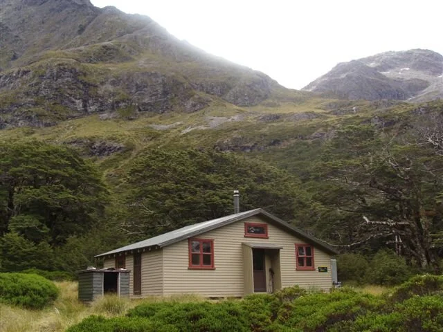
About half way up the Hurunui River we came across a fisherman and his guide who had flown in by helicopter for a day’s fishing, The guy had just hooked a massive fish and after the photo session, put it back in river. Personally, I think if you go fishing, you go to catch a feed, but that’s just my opinion. The 1st hut on the track is the Kiwi Hope Hut a lovely Lockwood style of house, with 2 separate bunk rooms and a huge living area. It is set at the end of a long river valley (the Hope River) so the outlook was great and we had it to ourselves.

As soon as we started heading up towards the West Sabine hut (about 5 hours walk) we could see just how much rain had fallen recently. Although not actually raining as we started off, the track was very waterlogged and muddy. About an hour up the track I managed to stand on a slippery log in the middle of a mud puddle and fell flat on my back like an upturned turtle!! I had to unhook my pack to get up again and then realized a far greater disaster. POOR TIRI WAS HOOKED ON THE BACK OF THE PACK!! He was completely immersed in the mud and we even had to pour the mud and sludge out of his gumboots. He does seem to have made a full recovery now and has had a shampoo and blow dry on our return to civilization. He is now sunning himself on the porch as I write. (Strange behavior for a kiwi one can’t help but think). The track up was a mixture of beech forest and across some pretty large avalanche tracks. We actually got up to the West Sabine hut in the time that was stated, which was a pleasant surprise after the Wangapeka. There was a hut warden in residence at this hut for the night. Henry, (as in Henrietta). Although German by birth, she has spent a large portion of her life her in NZ and has probably tramped over more tracks than 95% of NZers. She covers 6 huts on her circuit, usually staying in each hut a night or two and then moving on to the next one. A very fit young lady as I am sure you can imagine. Day 2 was a 4 hour walk up to Blue Lake hut, our next stop on our way to the pass.
The next morning was one of those really magic mountain mornings which make it all worth while. Mist hanging in the valley floor, clear blue skies, the sun just shining on the mountain tops and not a sound. The sort of morning when you really couldn’t want to be anywhere else. We set off at about 8.00am and just enjoyed the atmosphere of the whole place.


We climbed up and over Kiwi Saddle, a whole 660 meters, again on well-benched and maintained tracks. Shortly after, we got our first glimpses of Lake Sumner, which we eventually dropped down to the head of.

One crazy member of this intrepid pair went for a swim! And it sure as hell wasn’t me! All the major river crossings on this side of the pass are bridged, so dry feet again!

Second night was at the Hurunui hut, again we were the only occupants. We have a mountain radio with us, which we turn on at 8.00pm every evening to get the latest mountain forecast and any messages. It is a great service and certainly worth the extra ¾ of a KG weight. It can sometimes be a bit of a bugger swinging the aerial out and often calls for a bit of good ole Kiwi ingenuity!

On this particular evening we got 2 messages that put a bit of a damper on the rest of the trip. The first was that my Dad had been admitted into hospital and had to have a pacemaker fitted. He has since had this done and is fine, but one feels a bit helpless out in the middle of nowhere. The second bit of news was that the two hunters we shared a hut with nearly 4 weeks ago at Branch Creek hut had both been medi-vaced out by helicopter with leptospirosis, a bug normally contacted through water contaminated by rat’s pee.
I have since been to a doctor who assured me I would know by now if I had it. I do feel fine but my thoughts and best wishes are with these 2 guys who treated us so well a few weeks ago.
Day 3 was our shortest day and also the most enjoyable. Again, the track was well marked and benched and still nice and flat! But the highlight of this particular section was the natural hot pools about an hours walk from the hut. As you walk along the track, suddenly in front of you is a stream with clouds of steam rising into the air. A short scramble up the side of the stream and you come to a pool about half a metre deep and about 30 degrees Celsius. What bliss! DoC have very thoughtfully put a sign there warning you not to put your head under the water. Unless you were only knee high to a grasshopper I think it would be somewhat difficult to do so!
BE WARNED THAT THE FOLLOWING PHOTO MAY OFFEND.

Anyway, after a leisurely soak and scrub it was on to our next abode .The No.3 hut is an old type of hut and as with the previous 2, is well maintained and really comfortable. Along side this hut is a weird looking DoC staff quarters, which looks like a couple of over large corrugated iron water tanks cut in half and a small plastic house built on the front of them. Unfortunately, I couldn’t get a decent photo of this so you will have to use your imagination. This hut is set in the centre of the Hurunui Inland island, an area that has and is being trapped and now has a fairly healthy population of Great spotted Kiwis and a few Orange Crested Kakiriki. We heard a number of Kakiriki calls but never saw which ones they were. As it was still early afternoon we strolled on to the next hut which was a real old type cullers hut. Built in 1955, I don’t think anything has been done on it since.

Still, I’m sure that if it was snowing and blowing a blizzard you would be very grateful to see it. I am so glad we decided to stay here, as about 10pm the very unmistakable cry of the male Great spotted Kiwi was echoing through the valley. A few moments later he was joined by the female and on the occasions we awoke through the night, they were chatting away to each other. As with the beautiful dawn we experienced a couple of days earlier, this goes down as another one of those moments you could never experience anywhere else on this earth. The following day dawned a wee bit cloudier than the previous 2, and I thought for sure we would again be cheated of any views from the top of the pass. As the morning wore on the cloud cleared and before we realized it we were at the top of Harpers Pass. A nice, easy climb up and a well benched track to walk on. Just like all passes should be!

It was the 6th pass/saddle on my trek so far and I was about to enter the 3rd National Park (Arthurs Pass). The views down to the Taramakau Valley were awesome and we knew that within 2-3 hours we would be down there.

One of the things I was stunned to see was the flowering Southern Rata all over the mountainsides. It was magnificent! I never realized just how prolific these are down in this part of the country. The track down this side was a lot steeper than the side we had just come up and often following dry creek beds and again I was so grateful the weather was on our side. It was a 6 hour walk in total to our final hut on this track. Locke Stream hut was built in 1940 and renovated in 1993 thanks to a bequest by some kind hearted ex-culler. The view from the porch speaks for itself

Unfortunately, some bloody grubby sods had been in here some time previously and left behind a mountain of rubbish. I have never been able to understand why these sort of people even bother coming out to places like this. Eric, god bless him, loaded up a large empty bag with it all and carried out the following day.
The final day was down the mighty Taramakau River and it wasn’t hard to imagine what this river would be like in high flood. The debris lines were, in places, about a hundred meters from the river we now followed and there were some pretty big logs that had been deposited by past floods along the way.

Again, a well marked track through to Kiwi hut, about 3 hours walk down the valley.

From here the going got to be the hardest part of the whole track. It was just a matter of picking your own way along the river in what you though was the easiest route. Sometimes boulder hopping, sometimes through very fine gravel and the occasional river crossing. The river was really low so we only got wet feet twice! But the previous 4 days we managed to get through without once going over ankle deep! Wonder of wonders! On the banks of the Otira river we stopped for our last gourmet lunch of, you guessed it, peanut butter and salami on corn cakes and then waded over the river (again below the knees) to our pick up point and the end of what I have already said is the best part of the trek so far. All you lucky people who live within striking distance of this place, do yourself a favour and get yourself onto this track. I would recommend starting from the Lewis Pass end, 1 night at Kiwi Hope hut and then a couple of nights at the Hurunui. From here it is an easy hour’s walk to the hot springs and they are great. You could then walk out the same way or exit via Lake Sumner or go on over the Harpers. Whatever way, I am sure you would love it.
Eric, it really was a fantastic walk and thanks heaps for your company.
So, why am I now sitting behind the Papanui Workingmen’s Club??
The friends who picked us up at the track end have been using our camper over the past week and are now flying back to Europe so they had to be dropped off at the airport. Plus my pack (Sorry Pete, YOUR pack) came unstitched and had to be repaired. My boots also need a bit of mending but at the moment are too wet to do anything with and the weather is very dull and overcast so the chances of them drying out enough before Wednesday are somewhat remote. But the main thing that brings me back to the big smoke is the fact that my number one supporter and best mate arrives tomorrow. Marilyn is coming down to drive the camper (aka "The Mothership") between stops for me over the next few weeks. Between Arthurs Pass and Lake Wanaka I have a fair bit of road walking to do and when I do go "bush" it will only for be for 1or 2 nights at a time. How wonderful it is going be to stagger out at the end of the track to have a cold beer and a hot shower waiting, Oh, and the wife as well of course!!
Till next time stay happy and take care.
DONATIONS $7670
Weekly Update No.14- Thursday 12/02/10
Goodbye to the Papanui Workingmen’s Club and its great roast dinners and its beautifully cold Speights Summit draught beer. Goodbye to Marilyn (after only 17 hours!) and back up to Arthurs Pass to pick up from where we left off 2 days ago. This leg takes us up over the Cass Saddle (Pass), down to the Harper River and through to Lake Coleridge. Eric, obviously a glutton for punishment, decided to keep me company on this stretch as well. It had rained a little the night before and the clouds were hanging low and threatening over the mountains as we started off up the Cass River about 10.15 am. I really hate these tracks where you have to wade across knee deep water in the first 10 minutes and then manage to avoid all the other creeks etc for the rest of the day. Again, a pretty easy walk once we had picked up the track leading up to the pass. The valley is really pretty badly eroded and, as Eric stated, the South Island is never going to run out of gravel for road repairs!

We had to cross several old and not so old slips and avalanche paths. Once up into the bush it was easy walking along benched tracks and bridged creek crossings. I have been really impressed with the Arthurs Pass National Park’ standard of track and hut upkeep. Although nowhere near as heavily used as some of the other national parks in the South Island, they have all been up to a high standard and I really can’t think of anything negative to say about them. Long may it stay this way! A lunch stop at the "quaint" old Cass Saddle hut and it was up over the pass itself.


We were accompanied for a fair bit of this stretch by a flock of 10 keas. They kept their distance but made sure we knew they were around with their melodious song. As much as I love these clowns of the mountains I am a lot happier when there is a wee bit of distance between us. I have in the past personally experienced the odd close encounter with these dear sweet creatures. How wonderful it is to return to your tent or bivvy to find that a flock of keas had paid a visit in your absence. If you are VERY lucky, you MIGHT find something that is still recognizable! The cloud was sitting right down on the pass (1326 meters) so we didn’t dally around long and again, the "wonderful views" were non-existent.

Heading down the Hamilton River was similar to the way up. The forest was pretty much all mountain beech with the odd mountain toa-toa thrown in. It was along this stretch of track we saw the only NZ falcon we have seen on the trek so far. The interesting thing about this particular part of the forest was the understory. In some places the small trees were so thick it would have been impossible to walk through and a couple of hundred meters down the track, there wasn’t a young tree to be seen. The other thing I love about beech forest is the great variety of fungi that is about.


We arrived at the Hamilton hut about 5pm. A lovely comfortable hut set up on a terrace overlooking the Hamilton River. There were 3 DoC staff in residence there repainting the outside of the hut plus 3 young ladies from Landcare Corp. doing research on some vegetation blocks up the valley. 2 of these ladies were from France and the 3rd was English. Haven’t we got anyone in NZ who can do this sort of work? Seems strange to me we have to get overseas people in to study NZ flora. Maybe I am just a grumpy, cynical old bugger after all. Anyway this was the first hut we had to share for sometime!
When we arrived I was sure I recognized the senior DoC ranger, but, as the years advance, the memory retreats, so I couldn’t place him, but knew damn well I had seen him some time in the past. A couple of hours later I was flicking through the hut book and saw his name and everything clicked into place! In my very first update about a million years ago, I said that I first wanted to do this walk 30 years ago. (Actually I exaggerated a bit, it was only 24 years ago!) The guy I planned to do it all with was a fellow guide working with me at the time for Greenstone Valley Walks. Jim Henderson and I did a couple of seasons together and then as often happens, went our separate ways and the whole plan just remained a dream for me until now. And now, bugger me, here was Jim Henderson sitting opposite me in the Hamilton hut in the middle of the A.P.National Park! He had gone on to do some pretty amazing things over the past 24 years. Two 1-year stints down on the ice in Antarctica, a year on Campbell Island, working for DoC in some of the most interesting places in NZ and even a stint in Victoria, Australia fighting the bush fires there. It was fantastic catching up with him, particularly whilst in the middle of doing what I’m doing: The walk he and I planned all those years ago. Jim, if you read this, rest assured I WILL darken your doorstep again in the very near future. Catching up with you again after all these years really has been the highlight of my trek so far. I even intend hitting you up for some sponsorship!

The weather gods ceased smiling upon us that evening. They didn’t exactly start scowling, just frowning a little and I had to put my coat on for the first time in 5 weeks to do the radio sked! We were away from the hut before 7am next morning with the cloud and mist laying everywhere. The forecast was for more rain so we wanted to get out before the worst of it hit us. It never did eventuate. It was a very easy 21 km stroll out, mainly following a 4 wheel drive track all the way out. This did involve about 20+ river crossings but with there being no rain to speak of for weeks, these weren’t a problem. With this amount of river crossings the only sensible thing to do is plunge straight through the first one, get your feet wet right from the beginning and just wade through the rest. It is amazing how much time people waste trying to keep dry, only to slip on the second to last crossing! The water is bloody cold though and as Eric said "how can you get an ‘ice cream headache’ walking through water?


Unfortunately, because of the low cloud we missed ‘The Pinnacles’ a collection of weather worn rock pillars half way down the Harper valley. But this was more than compensated for by the continual changing moods of the valley with the mist and cloud swirling around.
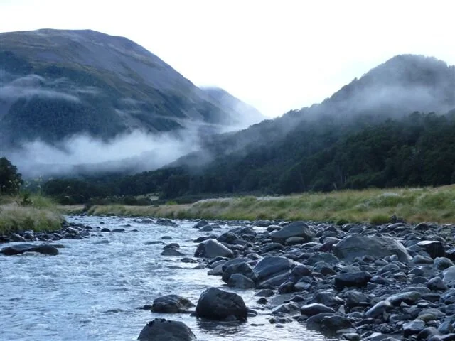


Five hours later we arrived at the Harper Rd end and there was the very welcome sight of ‘The Mother ship’ parked there in the car park. Marilyn had driven it up from Christchurch that morning and arrived about an hour before us. What a luxury to be able to have a cup of real coffee and change into dry footwear.
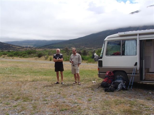

Alas, it was here I was to suffer rejection as I have never experienced before. As it was lunch time, I dragged out the corn cakes, salami and peanut butter as I had done every day over the past week or so and told Eric to help himself, as I had done every day over the past week or so. Marilyn then offered him fresh bread with cheese and tomato sandwiches. WOULD YOU BELIEVE HE ACCEPTED THAT OVER MY OFFER!?
I was stunned beyond believe! This person I thought was my friend! This person I had puffed up mountain passes with, forded icy cold torrents with, listened to the calls of kiwis with, had rejected this kingly lunch we had dined on every day over the past week or more in favour of fresh sandwiches! There really is no understanding some folk.
So as not to appear a martyr, I had to accept Marilyn’s offer as well and grudgingly devoured about 6 of these. Eric has now returned to Auckland and in all seriousness I am really sorry to see him go. We had a great trip over the Harpers Pass and now down Harper river. He was great company and a fountain of knowledge when it comes to our fauna and flora. Thanks again Eric, I am sorry you couldn’t continue on down to the Rangitata as we hoped.
So, here we are on the banks of the Rakaia River and deciding what to do next. The weather forecast is for heavy rain and thunder tomorrow so I am leaning more towards just following the back country roads down to the Rangitata rather than go across country following the Te Araroa Trail through the Mt Hutt and Taylor Ranges. Trouble is, with all the fine weather I have been having, I think I am turning into a "fair weather sailor"!
Will let you know how it goes next time. Keep smiling and stay happy.
DONATIONS $7860!!
I always hoped I would be able to hit the $10,000 for our kiwi friends and at this rate it looks like it may happen!!

Tiri catching up with his mates and showing them where he has been.
Weekly Update No.15- Saturday 20/02/10
Greetings from the shores of Lake Clearwater on a beautiful Saturday morning. Just getting packed up ready to go and cross the 4 km wide braided Rangitata River. All reports suggest that it should be low enough to ford across, I sincerely hope they are right as it’s a long way to drive around to the other side.
Anyway, back to where we left off last update, camped on the side of the Rakaia River. My plan was to ford the river on the Saturday but during Friday night a screaming nor-wester blew up and heavy rain fell in the Alps, enough to force the rerouting of the Coast to Coast race which was held that day. We should have realized that something was about to happen from the cloud formations the day before.
The wind was such in the morning that we could hardly stand up in it, let alone waddle across a river. So being the intrepid couple that we were, we headed into Christchurch once again, this time to get my boots fixed and pick up Phil Soole who is going to keep me company for the next 2 weeks. Phil and his brother Pete did the Wangapeka with me a million years ago. Some people never learn.
The boot repair job was a success and once again when I explained to the boot maker what I was doing and he didn’t charge me, so if you are in ChCh and need boots repairing, go to Ferry Road Shoe Service, 188 Ferry Road.
We picked Phil up and headed up to the southern side of the Rakaia opposite the Wilberforce confluence and headed up the Turton’s saddle at 1120m.

We could see the weather coming in from the NW and the forecast didn’t sound too flash but not too horrendous either. This was amazing country, huge sweeping Canterbury high country.


We didn’t see any stock anywhere but lots of native skinks and believe it or not, great flocks of black-backed seagulls, even up at this height. They gave the impression of being vultures circling around.
As we dropped down into the Turton’s basin towards the Comyn’s hut we could see the structure stuck out in the middle of nowhere which from a distance looked like a long-drop. As we approached it, we realized that is just what it was, They obviously expect a lot of strong winds down this valley.

For the last hour and a half walk down to the hut, we had to put our raincoats on – for the first time in over 4 weeks. We got to Comyn’s hut which was built in 1957 to replace the original one built in 1890. This is listed as derelict and Boy, they are not kidding!

The new one is made completely out of corrugated iron which is all proudly labeled ‘Made in Ebbw Vale, Great Britain" nowadays I imagine it would all be labeled’ Made in China’.
The mountain forecast that night again didn’t sound too bad, just showers and high winds. We set off the next morning at first light and by 10 to 7 had our boots full of freezing water crossing the first of 37 stream crossings. We climbed up towards the Clent Hill Saddle through thick tussock interspaced with matagouri and wild Spaniard, two of NZ’s wonderful alpine species so welcoming to trampers. We got to the top of the saddle at 1480m where we were told that on a clear day you could see for ever.

At this stage we could see the valley floor and that was about it. At the top of the saddle it took us quite some time to find the downward track marker. It was well to the right of the top of the saddle and half way along the 400m scree slope we had to sidle along.

It was about here that things started turning to custard.
The cloud that had been further down the valley was suddenly upon us. It was a lot thicker and wetter than what I had experienced on the Waiau Pass. We really couldn’t see from one marker to the next and had to repeat the experience of one staying by the marker while the other set out to find the next one. As a lot of this track was along narrow ridges we really didn’t want to head the wrong way. The temptation of course was to drop down and follow the river valley but after consulting the map and seeing the gorge which was half way down the river, we didn’t think that was such a great idea. Occasionally the cloud would thin enough to allow us to see the next marker which we would then make a beeline for. I imagine that on a fine day the views from there would be absolutely spectacular. We could barely see our boots! We battled through this for some 2 ½ hours. The thing that concerned me the most was that after checking the GPS regularly was that we didn’t seem to be dropping any altitude. We were still at 1400m. Eventually we did start descending and the cloud started thinning so following the markers was much easier. We finally caught sight of Lake Heron and the huge basin below us and descended rapidly.
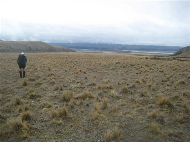
A relief to be out in the open again and out of the tussock, matagouri and spaniard and onto shorter grass. We stopped and had a good look at the map and saw that instead of coming down the Swin River valley as we’d assumed we would, we did in fact come along a parallel valley. An hour and a half walking along the flat we spotted the Mother Ship parked right where it should be. We started smiling and the pace picked up in anticipation of the fresh scones, hot shower, cold beer and steak dinner which awaited us. We were not disappointed!
This piece of track was a real wake up call to me personally as the last 2 legs of the trek had been a piece of cake, easy tracks, wonderful weather and good visibility. It is very easy to become complacent and blasé about tramping in fair weather and then, suddenly things can change dramatically. I wasn’t unduly worried about our safety as we both had all the right gear, survival bags and good warm and waterproof clothing. Even so, I am damn glad we didn’t have to spend the night in the open up there.
The next day dawned magnificently. Calm, warm and clear and Lake Heron was a picture to behold.

Phil and I only had about 20 km of flat road walking to do today so it was a leisurely start in the sunshine with a 5 star lunch stop looking back at the Pass we’d struggled down yesterday now crystal clear against a blue sky and looking most inviting. But we overcame the temptation to retrace our steps of the previous day!
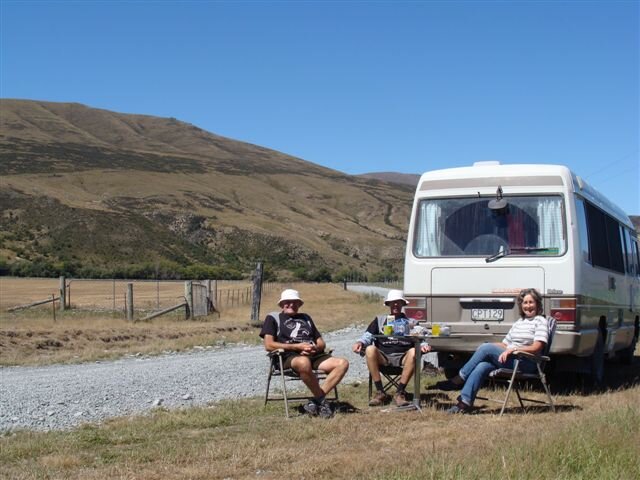

And that brings us to Lake Clearwater and a paddle across the Rangitata.The walk up here gave us the most incredible views of Mt Cook and the Southern Alps.

The plan over the next couple of days is across the river, overnight at Mesopotamia Station (one of the biggest high country stations in NZ), over the Two Thumbs Range and down to Lake Tekapo, where, hopefully, the Mothership and back up crew will be waiting on Monday evening with more hot scones and a smiling welcome! The weather forecast sounds pretty good so here’s hoping.
Will let you know how it went soon. Take care and keep smiling.
DONATIONS TO DATE $7940!!
Weekly Update No.16- Thursday 25/02/10
Well over halfway now !

What an interesting last 5 days. The very highs and the very lows of the whole trip. Even now, I think back over them and am still stunned when I think of what we have done and what has happened. As I ended my last update we were about to cross the Rangitata and spend the night at Mesopotamia Station before heading across the Two Thumb Range. Phil, Marilyn and I set off about noon last Saturday for the place we had been advised to cross. Bear in mind that this river bed is over 4km wide here and braided like you wouldn’t believe. We had also been told to expect to take up to 4 hours getting from one side to the other. Marilyn walked with us down to the river’s edge, about an hour’s walk and then backtracked to the camper to drive around to Tekapo to meet us in 2 days’ time. Before we started to cross the river proper, I turned on the GPS so that if we had to backtrack we would know which way to go. The first channel was pretty shallow, but I was amazed, that even at this depth, how fast the current was. The next half dozen or so braids were fairly easy going but then we hit what I guess was the main channel. We walked upriver for about 400 meters before we found what looked like the only safe place we could see. To be on the safe side, we linked arms and away we went. As I said, I was stunned at the speed of the current, and when it got to over our knees it did become pretty difficult to stay upright. It was only about 30 meters wide and we finally got to the other side about 20 meters down from where we had entered the water. From there we paddled across another couple of shallow streams and suddenly, that was it!! We had done it. We had crossed one of the biggest rivers in the country without any real drama at all. It was all pretty anti-climatic actually, so we sat down and shared our one and only apple to celebrate.


From here it was another hour or so yomp to the homestead and our stop for the night.
Mesopotamia, one of the iconic high country sheep stations of NZ. Up to a couple of years ago, this was a 26,000 hectare property, with several homesteads and even it’s own school, which officially closed last year.

Now it is 5,000 hectares, with a 30 year hunting and tourism concession over the other 26,000 now under DoC. While wandering around the property that evening, we met a chap who used to muster up in the hills who, when we told him our plans to get to the Royal hut next day informed us "we were dreaming". After chatting with him for a while, he advised us not to try the Te Araroa Track and instead, go up Forest River and over the Bullock Bow Saddle, a route I had actually looked at some time ago. He said the track was easier going and most of it followed an old 4 wheel drive track, which sounded appealing. He also said it wouldn’t take nearly as long. Yeah Right!
We were up and gone at first light and it really was a glorious start to the day. Sun shining on the mountain tops, deer watching us from a distance and not a cloud in the sky (boy, we were sorry about that later). The climb up and over the saddle was long and steep, a climb of over 1000 meters to the top at 1625m.

The views were fantastic and we could see the next day’s challenge, Stag Saddle on the other side of the valley.


By this time the temperature had reached over 30 degrees and even the wind was warm. We had a quick lunch at the top and then headed down to Bush Stream to pick up the track to the hut. A lot of this route was over scree slopes and avalanche debris and with the sun beating down reflecting off the rock, you can imagine how hot it was. Yes, I know, last week I was bitching about the rain and cold, no pleasing some people! We eventually got to the valley floor and pushed our way through the usual collection of matagouri, waist high tussock and wild spaniard. We finally arrived at the Royal Hut nearly 11 hours after leaving Mesopotamia. A very long and hot day. Royal hut was so named because Prince Charles apparently stayed here some years ago. I just hope it was in far better condition then than it is now! What a tip! By far the most rundown and uncared for hut I have seen on the entire trek. Dirty, rubbish everywhere, food containers with contents left all over the place and even the old horse-hair mattresses!

Still, I guess if it was wet and windy, it would be a welcome sight. Besides, we were both that stuffed we would have slept on a bed of nails that night. As there were no trees around for at least a 100 km’s, we had a bit of a job putting the radio ariel up, but no problem to "Stepplejack Phil"

The following morning saw us gone before day break, complete with headlamps as we were aware the climb up to Stag Saddle was a 4 and a half km track and to allow 3 and a half hours to do it.

As the sun rose behind us we were a third of the way up, again, a really fantastic morning. Before we knew it, (2 and a half hours later actually) we were on the saddle! At 1945 meters the highest point of my trek. Looking south, we had the most incredible views over Lake Tekapo, Lake Pukaki, down towards the Lindis Pass and behind us the route we had just come up. It really did look pretty steep but I guess doing it at this time (and partly in the dark so we couldn’t actually see how steep it was) we really had no problems at all getting up to the top.

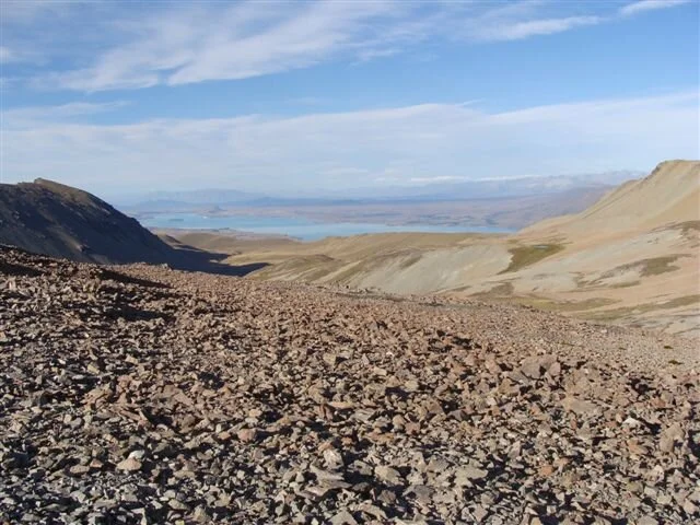


I even got a phone signal and phoned Marilyn who was in Hammer Hardware in Geraldine at the time! As we started off down the other side I was feeling really pleased with myself having put this behind me. But…….
Going down the valley became more and more difficult with no track as such and only the very occasional pole marker. The ground was very uneven and broken, the descent was steep and slippery and you couldn’t see your feet through the thick tussock. About 45 minutes later Phil pulled up with a very sore knee and slowed up considerably. I took what I could fit into my pack from him and on we went. By now the sun was right above us and it was getting hotter than yesterday. Luckily we were following a stream down so water wasn’t a problem. The day dragged on and got hotter and so did we. Poor Phil was in a lot of pain and the going wasn’t getting any easier. Finally, 5 hours after leaving the saddle, we hit an old 4 wheel drive track which we knew would lead us to an old musterers hut. called Camp Hut, it is a great wee place. A huge improvement on our last night’s abode. We had to make a decision here on what to do. We had 3 options: Either Phil stayed here while I went the 10 kms down the 4 wheel drive track to the nearest sheep station homestead and get someone to drive up and pick him up; or we stayed at the hut for night and re-assessed things in the morning; or we carried on the way we were going and hoped we got to the road end before dark. I was concerned about the fact that we had arranged for Marilyn to meet us at 2 o’clock that afternoon and it was 2.00 now with still at least 3 hours to go at a normal pace. Phil felt he could carry on at a slow pace so after a break we set off again. Even at this hour it was still baking hot and we were both getting pretty badly sun and wind burnt despite all the precautions we took. The going stated to improve a little and we were making reasonable time when we spotted the poled route taking us out of the river valley and straight up a bloody long steep mountainside. Talk about the sting in the tail! I don’t think either of us had sweated so much before. After an almost vertical climb of nearly 400 meters, we finally reached the top and started sidling around the ridge line to the road end at Tekapo ski field. As we neared the road end, I could hear the sound of road working machinery away in the distance. I looked at my watch, saw it was 4.15, guessed whoever it was working would most likely knock off at 4.30, so said to Phil I would run and try to get to them before they finished and see if someone would come and pick him up at the road end as we still had about 8 kms to walk down the road before our meeting point with Marilyn. Running with a full pack and boots on in 30+ degrees might be great training for the Royal Marines or SAS, but it ain’t no good for an overloaded, overheated old geezer, believe me. I finally stumbled (literally) across this construction crowd doing some road realignment work about 2 km down the road. I have never felt so utterly stuffed in my life! They were a great bunch of guys and within a few minutes we were in a ute and heading back up the hill to pick Phil up. I am sure he was even more relieved to see these guys than I was. When I mentioned that we were supposed to have been meeting Marilyn at the bottom of the road 3 ½ hours ago, Steve, the owner of the operation, said he had noticed a camper had been parked at the bottom of the hill for a few hours and then ran us down to where it was parked. The relief all round was enormous and after several gallons of good old Raro (almost pure sugar drink), we started slowly reviving. I finally plucked up the courage to take my boots off, and sure enough, three toenails completely knackered. No doubt that running down hills on gravel roads in tramping boots is injurious to one’s digits. That evening, over several cold beers, we decided that the next day was definitely a day off. I think the fact that neither of us could walk more than mere centimeters without pain was the deciding factor. Tuesday dawned the same as the previous two days, hot and sunny, so we decided to treat ourselves with a flight back over were we had walked the previous couple of days. Air Safaris, based in Tekapo, is owned by a friend of Chris Potter (the guy who held my hand over the Waiau Pass) so we gave him a call and he looked after us royally. He put us on one of the scenic flights over Mt Cook and the west coast glaciers, with a side trip up over Stag and Bullock Bow Saddles and back almost to the Rangitata River. Let me tell you, flying beats the hell out of walking anytime! What had taken us what seemed an eternity to traverse, we flew over in about 30 minutes! It really was a whole new perspective, looking down on everything. Even Royal Hut looked pretty good

The flight over the Southern Alps and the Fox and Franz Josef glaciers was breathtaking and is without a doubt, the most spectacular flight I have ever done. As Phil said, it has to rate amongst the best in the world. I could never recommend this company or its operations highly enough and no one in their right mind could fail to be blown away by a flight over this part of the country.


Have a look at their website www.airsafaris.co.nz
Due to various reasons, we decided to stay in the Lake Tekapo Motor camp for the night. Grief, how I hate these places. What is it that makes the people who run these places so grumpy, rude and so unhelpful? They charge like wounded bulls and then charge extra for everything else. Give me a lovely little river or beach to park on every time.
Back to reality the next day and the prospect of having to limp along 35 km to Lake Pukaki on the road alongside the huge canals here in MacKenzie country that are part of the Tekapo-Pukaki-Ohau power schemes. Phil decided he thought he would be better off taking another day off so I set off on my own for what I thought would be a boring road walk. How wrong I was. It was great. This time the breeze was nice and cooling and the views were, again, fantastic. Across the burnt plains up onto the Alps and Mt Cook there in all its glory.
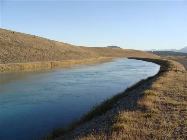

I do have a confession to make here though. Before setting out on this trek, I bought myself a MP3 player and loaded it up with talking books which have been a real god-send on many an evening in huts. I also downloaded a few of my favourite music albums. I have always frowned upon people I see walking along with these bloody things stuck in their ears. As I was walking on my own and there wasn’t much to hear I became one of these frowned upon folk and stuck this thing in my ears. The first 2 songs I listened to were "What A beautiful day" and "Made in heaven". What better titles could I have picked for this time and place. A couple of hours into this walk a group of cyclists stopped and had a chat with me. One of them hung back after the rest took off and we chatted, walked and cycled for about 10 minutes or so. As she left, she wished me well and asked me my name. She then introduced herself. Allison Roe! Probably NZ’s best ever female long distance runner! Funny the places one runs into people. Marilyn and Phil met me in the Mother Ship for lunch at the Mt.Cook Salmon Farm, situated on the canal between Tekapo and Pukaki. An interesting enterprise to say the least. Started in 1995 it holds about 120,000 fish at any time. They turn over about 70,000 fish per annum and this produces approx.110 to 120 tonne of fresh or frozen salmon. A fascinating place to spend a bit of time and fun to watch the feeding frenzy when the feed is thrown into the pens. Their hot smoked salmon is to die for, can’t recommend it highly enough!
Have a look at their website for some great salmon recipes. www.mtcooksalmom.com
We spent the next night on the shores of Lake Pukaki and it actually rained! For a full 30 seconds! The weather over the Alps looked a bit threatening but it stayed up on the mountains and again the morning was wonderful.

Phil joined me on this second and last day of canal walking from Pukaki to Lake Ohau. I must mention here the wonderful colour of the water in these lakes.

A real turquoise blue, caused by the "rock flour" ground out of the glaciers that feed the rivers that flow into these lakes. So the pair of us cripples and Tiri of course, hobbled along against the backdrop of the Alps and the sun on our backs the 25 km to Ohau.


This really is an interesting part of the country and other than our injuries and chapped lips it’s a pretty damn fine life!
Take care, and never give up!
DONATIONS $7962.
Weekly Update No.17 - Thursday 02/03/10
27/02/10
Hot, hot and very hot! Camped on the shores of the Ahuriri River just out of Omarama and boy is it HOT

This part of the country is just like a desert at the moment, very dry and very dusty. Hard to imagine that in a few months time the whole place could be under snow. Apart from the heat, have had a fairly easy few days, getting from Lake Ohau and now heading up to Lindis Pass. Due to the painful digits and Phils still pretty stuffed knee, we have had to do a bit of rearranging so far as our route goes for the next few days. Original plan was to cut around the bottom of Lake Ohau, across country to the Ahuriri and then down through the Ahuriri Conservation Area to the shores of Lake Hawea. What we have done now is get permission to use some 4 wheel drive tracks over private property and just walk along the fringes of the main highway. Doing this means I don’t have to wear boots and the ground is fairly level and easier on Phils knee. We have come down from Lake Ohau, followed along the Ahuriri River, past some interesting formations in the clay cliffs and down to Omarama.

From here we have followed the main road towards Lindis Pass and tomorrow it is up and over Lindis Pass to a large high country station called Forest Range, were we have permission to use a private track which will bring us out onto the shores of Lake Hawea, which, all going well, we should reach on Monday afternoon.
We have 25k’s of main road still to cover and about 30k’s across the Forest Range Station. A mere stroll!
Had an interesting morning in Twizel yesterday (Friday) Gave a 15 minute interview over the local radio station. It was quite fun, actually. Not having to see anyone and just answer the hosts questions. I was a lot more confident and relaxed then I know I am going to be on Tuesday evening when I have to address the Lake Wanaka Rotary Club!
But back to Twizel. I have only ever passed through this place in the past thinking of no good reason to stop over. I have certainly changed my mind now! This wee place has a real heart and soul to it, which is a lot more than can be said about some of its neighbouring towns. The conservation work they are doing with the Kaki (Black Stilts) is fantastic Now with only 82 left in the world, they really have their work cut out. Again, an awful lot of volunteer hours have gone into this project. Aside from that, everyone we met was conservation minded. No one I spoke to was behind this stupid scheme to put intensive undercover dairy farms down in this part of the country. As I said, this place is a bloody desert and the only 2 things I have seen that seem to thrive here are rabbits (zillions of them) and wild sweet briar. It was never intended for dairy farming, end of story!

But back to Twizel (again). The local bakery builds a bloody good sausage roll and even better steak pie and Tania from the Twizel Pharmacy is an expert on fixing mangled sunglasses! Ok, enough about Twizel.

Were we are camped at the moment is under the flight path from the Omarama Airfield. And what a busy little airfield it is. As I am sure a lot of you know, Omarama is the gliding capital of NZ and there is an almost constant stream of gliders being towed up into the wild blue yonder. (Come to think of it though, I haven’t seen any land!) It is not unusual to see about half a dozen of these machines circling around overhead at the same time. Not for this kid though. I don’t like flying in planes with engines very much!

28/02/10
Have knocked off the 25ks of road and are camped by the Lindis River, about 5k’s from our starting point tomorrow. Will be pleased to get off the road and into the hills again. The only good thing about road walking is that we are able to cover some good kilometers.

We have covered about 135k’s over the past 5 days which is pretty good going. We have been starting out as early as we possibly can (have just noticed the days are starting to get shorter) and knock off in the afternoon before the heat gets too much. The other advantage of an early start is you get a couple of hours before the traffic gets too much. We set off today about 4k’s north of Lindis Pass itself and were heading down the southern side before 8am. As Phil said " wish all our passes/saddles were this easy"

Wonderful plaque on top of the pass commemorating the 1st liberation of red deer into Otago! What a great moment to remember! Like the plaque in the Mt Bruce bird sanctuary near Palmerston North commemorating the 1st release of possums into NZ.
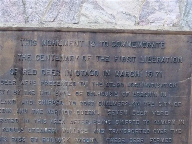
Another advantage of walking roads one usually drives over is all the things you don’t see when doing 100kph. Like all the road kill here are bloody ferrets and the very thin layer of topsoil on this part of the country. About 100 mls deep at most, little wonder the vegetation is a bit scratchy!


Was great to see our first clump of bush again for a week, never realized just how barren this area is

But even so, this is still a pretty amazing place.

01/03/10
This last section is called "Grandview Track" and a more apt name, you could never get. By far the most spectacular bit of the South Island I have walked so far.


Got away early again as the forecast was for rain in the afternoon and gales along the tops and they were right on the mark! The walk was steadily upwards through open tussock country and the views back towards the Lindis and over to the east towards Cromwell were amazing. The interesting thing was how different this open tussock country was compared to the stuff we went through further north. The ground actually had a greenish tinge to it and the tussock wasn’t nearly as course or hard. The mountainsides were dotted with the most amazing rock outcrops that resembled all sorts of castles and things, depending on how good your imagination was.

We gained just over 1000 meters in height over about 14k’s distance before reaching the top and managed to find a convenient rock to shelter behind for lunch. By now some of the wind gusts were so strong I was having difficulty standing upright and I was waiting to see Phil, who is considerably lighter than me, leave the ground on a couple of occasions. Once we had got over the top the whole outlook changed dramatically. We could see down the whole length of Lake Hawea and across the plains to Lake Wanaka. And Albert Town, where we were heading to
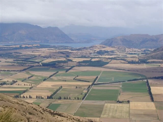
It really was a view to behold. We could also see the rain approaching down Lake Hawea at a rapid rate, so didn’t dally around up as long as we would have liked to. The descent was very sudden and we dropped over a 1000 meters in less than 4 k’s. It was the first time I had worn my boots for nearly a week to give my toes a chance to recover and the steep downhill was the last thing I needed. Fortunately I had taken my hiking shoes with me but it is going to be interesting in a couple of days when I head off over the Motatapu Track for 4 days. It was a race over the last half hour between the rain and ourselves, I think we won by a nose. Unfortunately, the time had come to say farewell to Phil. He has been with me for nearly 2 weeks, since the Raikia River, and I am really going to miss his wit, humour and can-do attitude to everything. We have been through a lot together, from the rain and fog on the Clents Saddle to the long baking hot days across the Two Thumb Range and our various injuries. Mind you, I doubt he will ever eat peanut butter or salami again. We drove through to Cromwell for the night and abandoned Phil at the bus stop in the early hours of this morning to catch his bus to Dunedin Airport. By the time this update goes on the web, Phil will be back in Brisbane beavering away at his desk. Thanks again for everything Phil, it was great!!
Marilyn dropped me off at Albert Town and I strolled along the Clutha to its outlet from Lake Wanaka and then around the waterfront to Wanaka township.


Getting to really enjoy walking without a pack and on flat land! My priority now is to put together a talk for the Wanaka Rotary Club tonight. Give me the Two Thumbs Range any day.
Catch you again next week. (if I survive tonight!)
Take care and keep smiling.
DONATION $7992
Weekly Update No.18 - Thursday 09/03/10
Well, survived the speech and the Motatapu track, both in the same week! To be honest, they were both great experiences and I would do either one again. While in Wanaka we stayed with a friend of a friend who owns a wonderful bed and breakfast, Falling Leaves, on the outskirts of Wanaka. Jo is a great person, with a great sense of humour and will keep you amused for hours with her tales about her days as a nanny for the rich and famous in the US and Europe. She also knows the area so well and everything there is to do around the place, so if you are looking for a cozy, friendly place to rest your weary head when passing through this part of the world, you won’t get better than here. www.fallingleaves.co.nz
Next day saw me walking around the lake edge to Glendhu Bay, the start of the Motatapu Track, a stroll of about 15 k’s. Along the way, I was met by a reporter for the Otago Daily Times, which resulted in a great article and a pic of Tiri and me on the lake edge in the following morning’s paper. The lake edge is a beautiful walk, flat and easy with Mt Aspiring and the Alps as a backdrop.

Thursday was back to reality and the first multi-day tramp I had done for a while. No more luxury of Marilyn and the Mothership waiting at the end of the day with a hot shower and a decent dinner. My daughter’s partner, Dave, flew down from Auckland to join me on this section and we got started at 1.00pm to get to the first hut, about a 3 hour walk.

Dave hadn’t done any tramping for a while and I think we were both a little bit nervous about things and both knew the Motatapu was going to be a fairly demanding wee yomp.
This section was pretty straight forward, passing through the 14,000 hectare Stack Conservation Area, one of the last remaining decent stands of beech forest in the area, and then a bit of a climb to the Fern Burn hut. The 3 huts on this track are fantastic. All only a few years old, and very comfortable.

The Motatapu Track traverses 2 high country stations, the Motatapu and the Soho. These 2 stations were both purchased by Shania Twain and her husband a few years back and one of the conditions of the sale was that they had to allow and finance this track and huts plus pay for its upkeep for the first 5 years, which is how this track came into being. Thank you very much Shania, I promise I will buy your next album, as I personally think what you have done here is fantastic.
I am so glad the standard of huts has improved over the years.
From...

to....

We had the hut to ourselves and on reading the hut book was surprised to see how few people use the track. There were also some pretty horrible comments about the next few days’ track, which I was hoping that Dave wasn’t going to see!
Day 2 was up and over the first of four 1,200+ metre climbs we had in front of us on this track, this one being Jack Hall Saddle at 1275m. A bit of a grunt first thing in the morning and over the next few days we discovered that every day started with a bloody great climb!

The descent down to the valley floor was the first section of track that was going to become the norm for long sections over the coming days.


It was as we dropped down to the river several hundred metres below us that the weather decided to change. The temperature suddenly dropped and a nasty southerly blow brought a squally shower with it. The wind got a wee bit on the fearsome side for a while and the rain was enough to get things wet and make things miserable for a bit. Fortunately, the next hut was only an hour or so’s walk from here and the rain stopped shortly after we got there, to clear into another sunny warm afternoon. We were joined that night by Jeff, an amusing bloke from the UK who informed us that the only other tramp he had done in NZ was up to Stag Saddle from Lake Tekapo! Took him 5 days for the return trip and he said it was bloody hard work. I knew exactly how he felt! He was heading out the way we had come in and had a great attitude to life. He also donated $20 to the cause. Again, some horrific comments in the hut book on the stretch of track we were going to travel the next day.
Daybreak saw us starting up the first of the two big climbs we had to look forward to today. The dawn was stunning and when we puffed our way to the top the vista that opened up in front of us made it all worth while. The track itself certainly wasn’t one you would take lightly, it sidled around some fairly steep drop-offs but so long as you watched what you were doing it really wasn’t a problem. We were lucky there was a nice cooling breeze blowing; the walking conditions up to now were ideal. We stopped for lunch half way up the next climb and came to the conclusion there really wouldn’t be a lot of lunchrooms with this sort of view! Some members of the party decided that this would be a great opportunity to make sure the inside of their eyelids hadn’t changed since last night!
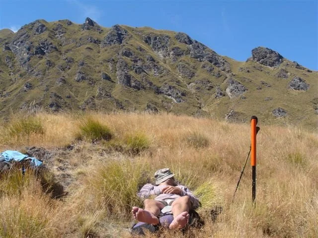
Another climb up along a fence line and then a very steep descent to the last hut. About a 600 metre drop over about 2 k’s in distance which did nothing for the feet for either of us!

Shortly before dusk that evening, we were joined in the hut by another chap who had walked all the way in from Glendhu Bay in 1 day, where we had taken 3! He looked completely stuffed and when we asked him what he thought of the view, he said he hadn’t stopped at all to admire it! It has never ceased to amaze me why people do this sort of thing. What exactly are they trying to do and why? Bloody idiots in my humble opinion. Barry left the hut at the same time as us next morning, right on daybreak again, and sure enough, I watched as he powered up the hill, not once stopping to look at what he was tramping through. Up and over Roses Saddle but considerably easier than the previous 2 days as this followed an old pack horse trail and was zig-zagged and nowhere near as steep

The descent down to the Arrow River on the other side was also gentle in comparison to the last couple and we soon found ourselves on the banks of the Arrow and all the ups and downs behind us.

The water level was so low we were able to walk the last 2 hours down the river itself much to the relief of hot and sore feet.


As we got to closer to Macetown the 4 wheel drive tracks along side the river got bigger and bigger until the whole place was virtually one large track. I don’t begrudge these people their fun, but wish there was somewhere else they would go and play other than a pristine river such as this one. The original plan was to camp the night at Macetown but as it was early afternoon, we decided to walk the 14 k’s into Arrowtown and have the next day off.
About 6k’s before Arrowtown a chap stopped beside us and offered us a lift the rest of the way, which we gratefully accepted. It was very hot and dusty and to all the purists who think we cheated, don’t worry, my next leg actually starts 12 k’s further north than were we finished! Turned out to be an interesting drive as this bloke worked on the Motatapu Station and over a cold beer in Arrowtown told us of some of his experiences there. Like fencing in the winter when the top 150mm of ground is frozen solid! He very kindly dropped us off where Marilyn had left the bus before flying back to Auckland for a few days. Sue owns this place and is an old friend of mine from the far distant past who I worked with on the Routeburn Track. She just happened to have a roast beef dinner on the go with enough to spare for a couple of hungry, weary but extremely pleased with themselves, chaps. It was a great walk, certainly up there with the best I have done. It certainly isn’t a track for sissies, but as long as the weather was good and you are reasonably fit and confident on your feet, go for it, I can guarantee you won’t be disappointed! Dave, it was a pleasure and a privilege to have you with me. I know you suffered a bit, but you never complained and overcame every obstacle. Thanks heaps for your company and I hope we get to get out again sometime soon.
I now cool my heels here until Sunday morning when we drive around to the Divide on the Milford Sound Road and start down the Greenstone Track to the Mavora Lakes Walkway and then through to Te Anau. Till then I shall have to suffer watching the sun set on the Remarkables every night. Helluva life really.

Take care and stay happy.
DONATIONS $8242
Weekly Update No.19 - Thursday 18/03/10
1157k’s DOWN - 93k’s TO GO !!
Sitting on the lake front at Te Anau. bleak, windy and cold. So different to yesterday as we arrived in glorious sunshine and a stunning day. I definitely think the summer is on its way out. Certainly can’t complain though, on the whole it has been a cracker as far as I am concerned. Back to last week though. Spent 6 days in Queenstown after the Motatapu Track and it was great catching up with some old friends and meeting lots of new ones. After a couple of warm and sunny days I awoke on Friday morning to bitterly cold winds and snow way down on the Remarkables!

Even the locals were complaining. Saturday the 13th was the day of the Motatapu Challenge, a bike race through the valley from Wanaka to Arrowtown and, for the first time, a run across the track that Dave and I had just walked. The runners had to be in teams of 2, carry locater beacons and be at certain places by certain times. I am sure there would have been snow up on the track but up to now I haven’t heard of any results but intend doing that today. Marilyn arrived back in Queenstown on Saturday afternoon as did my 3 walking companions for this leg. Colin, an old friend from Auckland who now lives in Milton, (yes, people still do live in Milton) and Willie and Rob from Auckland, who had made contact with me through the FOF website before I started this trek. After meeting up on Saturday evening the consensus was to start south of Kinloch on the shores of Lake Wakatipu and go up the Greenstone Valley as opposed to driving the 4 hours around to the Divide on the Milford Rd and walking down the valley. This was still well north of where we finished off last week so it wasn’t a problem. We set off on Sunday morning for one of the most beautiful drives in NZ, around Lake Wakatipu to Glenorchy. Stunning views of Mt Earnslaw and across the Lake towards the Greenstone Valley and Elfin Bay. Stopped off in Glenorchy for a coffee and was amazed at how much this place has grown over the years. This is one of my favourite places in the country and when I think I nearly bought a 3 bedroom house here 22 years ago for $75,000 !! It was far too expensive, this place was never going to change! We started walking along the Kinloch-Greenstone Rd about noon and up the valley a couple of hours later, leaving Marilyn to bounce back down the badly corrugated road in the Mothership and meet us at the Mavora lakes on Tuesday.

This is a valley I have walked up and down nearly a hundred times and it was as magic as ever! I was the head guide on this track when Greenstone Valley Walks started in 1985 and, for those who don’t know, was where I first met Marilyn. Needless to say it really was a trip down memory lane. It was also the first decent bit of bush I had walked through for some weeks after the dry, barren Canterbury and Otago high country. I loved it! In the first few hundred meters I got reacquainted with the bellbirds, robins and rifleman and so enjoyed the walk along the crystal clear river.

The track is so well maintained and even some of the smaller side creeks are now bridged, meaning that even in wet weather, you can get to the first hut without getting your feet wet!

The Greenstone Hut was relocated from the Greenstone Valley some years ago and now sits on a lovely sub-alpine clearing on the banks of the Sly Burn A very comfortable and spacious hut, with 20 bunks and a permanent hut warden in residence. Can anyone please explain to me why DoC doesn’t employ NZers for these positions any more? Have come across 2 hut wardens in my travels now, one German and one Japenese. Wasn’t like it in my day!! About 10 other people in the hut that night, the most crowded hut I have stayed in since the Heaphy nearly 10 weeks ago. The walk from there over into the Mavora Valley is a doddle. In fact this section was by far the easiest bit of track walking I have come across on the whole trek.

The Mavora valley itself is fantastic. A typical glacial valley with huge river terraces and moraine hillocks along the length of it. Our original plan was just to walk to the first hut for the next day, but as the weather was so good and the going so easy we decided to carry on another 4 hours to the Boundary Hut and give ourselves an easy walk out the following day.

The huts through here are very comfortable although fairly small, only 4 bunks in each one. Looking through the hut book I was surprised to see that few people actually use this track. It really is an easy and enjoyable walk to do.
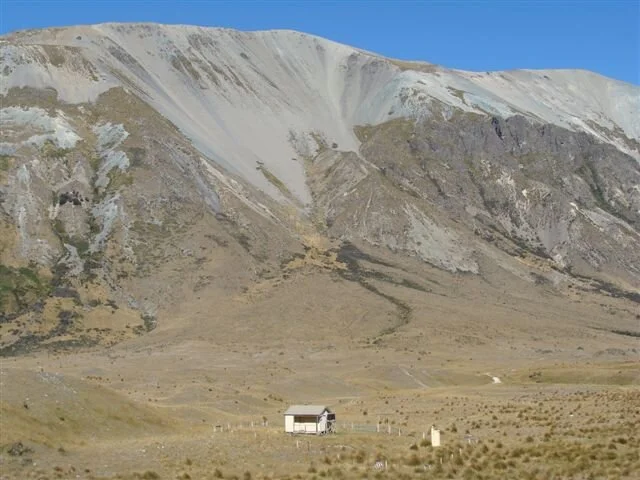
The only downside is the valley is now open to 4 wheel drive vehicles up to the Boundary hut and wide sections of it are getting pretty badly churned up. A real pity I feel. Tuesday dawned very overcast and dull and true to the forecast, by mid morning the heavens opened and stayed open till mid afternoon. No trip through this part of the country would be complete without at least one day’s rain! We got to the road end in good time and as we had 40 odd kilometers of road to cover to the highway we carried on as we were wet anyway and still had a couple of hours before Marilyn was due to pick us up. We covered about 9 k’s before the Mothership hove into view and then backtracked to the Mavora Lake DoC run camping ground which is wonderfully situated at the end of the lake and has great facilities. As usual, within a few minutes of stopping Marilyn had the scones in the oven and all was well with the world. This type of camping really is roughing it smoothly! It got bitterly cold overnight and sure enough, come morning we could see the mountains around us covered with snow. With 30 odd k’s of road still to cover we set off fairly early and went for it. It was great having Marilyn drive ahead and stop every 8-10 k’s to wait for us to catch up and refuel us with hot drinks and food. Like I said, roughing it smoothly! It was bloody cold though and it was close to 2pm before it warmed up enough to shed at least one layer of clothes. We knocked off the distance by 3.30pm, which considering the number of long relaxed stops we had wasn’t too bad I thought.

Which brings us to Te Anau, were we dropped off Colin to catch the bus back to Milton (yes, some buses still go through Milton) and Rob and Willie to carry on to do the Dusky Track. This was the route I was going to take to the south coast but for a number of reasons I am going to finish the last stretch on country roads. Reason 1 is my Dad is not too good and has been in and out of hospital recently and although he insists he is Ok, I would like to get home and say hello. Reason 2 is that the weather forecast for early next week isn’t too flash and having down the Dusky once in chest deep water, I ‘m not in a hurry to repeat the experience. The third and most important reason is that I am just plain bloody knackered! The last day’s walking in boots down the Mavora really stuffed my feet and parts of my body that up ‘til now have been fine are starting to twinge and groan. But don’t worry, if I have to finish walking on my hands I WILL FINISH!!
Will touch base again soon. Take care and keep smiling.
DONATIONS $8332
Weekly Update No.20 - Thursday 20/03/10
Oops! A slight error in the mathematics. Thought I only had 93k’s to go but ..it is actually 114 k’s (Bugger)!
Anyways, left wonderful old Te Anau and headed back to where we finished off yesterday with 13k’s of main highway to cover, joy of joys.
For your information there is 1 Maui camper every 2 minutes going to or from Te Anau and these are interspaced with tour buses full of sleeping tourists. I wonder how much of NZ they actually see.
Spent the night in Mossburn, which sells itself as the "Deer Capital of NZ".

Interesting going into the local store and instead of racks of women’s magazines, it was Rod & Rifle, More Pork, Game Hunting in NZ etc.etc. Real chap’s country, one feels.
19/03/10
Greatest distance covered in one day!! 42k’s!! Admittedly, all flat and on the seal, but, boy, still a bloody long way! Escaped the clutches of Mossburn about 8am this morning and stopped walking about 5.30pm. Mind you, this included a stop every 5 k’s for drinks, food and moral support. Have reached a stage when my morals definitely need supporting! Most of the day was wonderfully sunny but cold as a mother in law’s heart! I read some time ago a diary from some bloke who had done the Te Araroa walk and followed this particular route. He reckoned that this was the most boring part of the whole journey. I certainly haven’t found that! What a pleasure to walk through such wonderful green and fertile country again after some of the near desert I have been through.

This is real dairy farm country, not that dry barren crappy parched country around Omarama. Heard today that the plans to put intensive dairy farming up there have been put on hold. Thank goodness for that.
Passed close by White Hill Wind Farm, the only wind farm in the SI., 29 turbines producing enough power for 30,000 houses. Personally I don’t have a problem with wind power, but there again, they aren’t in my backyard!

Tucked away at present at the centre of the universe. A great place called Nightcaps! The name speaks for itself! If you haven’t been here, I really recommend that you keep it that way!

But this time it really is only 61 k’s to go.
20/03/10
36 more k’s behind us and just 25 left for the final push tomorrow! Bit harder today as most of it was into the teeth of a pretty strong westerly wind. Also a few hills thrown in just to remind me what they are like. Crossed the 46th parallel at one stage and walked under the huge pylons carrying the power from the Manapouri power station to the Tiwai Aluminum Smelter at Bluff. Straight as a die as they faded into the distance.


Walked through a few almost ghost towns en route. All these towns were built around coal mines and as these mines closed, so did the towns. I suppose at some time in the not too distant past these were thriving communities.
Dragged out the MP3 player again and walked the distance listening to Douglas Adams’ ‘Life, The Universe and Everything’. It is one very funny book! I don’t know what he was on when he wrote it, but I sure wish I could get some! So now camped in Tuatapere, 10ks from Te Waewae Bay and the end of one helluva stroll. Started raining a wee while ago and I guess it would be fitting for the last day as I started in the rain 72 days ago. Will tell you all about it in a day or so.
Don’t know what I am going to do on Monday!
Take care, and keep putting one foot in front of the other.
Weekly Update No.21 - Thursday 22/03/10
Back in Queenstown, 3 and a half hours to drive back over what it took me 8 days to walk!
Don’t quite know what to say at the moment.
Piccies say it all I think!


Flying back to Auckland tomorrow and will do a more comprehensive tome in the next few days.
Till then, keep smiling. I sure am!
Weekly Update No.22 - Friday 26/03/10
Greetings from Auckland. Left snow covered mountains and a biting southerly and arrived to cloudless sky and warm temperatures. A cloudy flight up, but the sky cleared just as we flew over Golden Bay, which I thought was very fitting, as I left here 78 days ago and started heading south. It took me 68 days to walk to Queenstown and 40 minutes to fly over the same distance!
But back to my last day on the road. The day dawned just as it did on my very first day, overcast and drizzly. I thought this was rather ironic actually and I still can’t believe how good the weather gods looked after me on the trek. Out of the 75 days I was on the trek, I had my wet weather gear out 5 times. Unbelievable!
Anyway, got started on my last leg just on daylight (about 7.15am now, as opposed to 5.30am when I first started out). Again it was along the road shoulder and nice and flat. Passed through the thriving metrolips of Tuatapere, which now touts itself as the "Sausage Capital Of New Zealand"!

What a claim to fame that is! Has got a great café and some pretty amazing art work around the place though.


After here it was just 10k’s to Te Waewae Bay and THE END! It really was a strange last couple of hours.On one hand I so desperately wanted to get to the end and on the other I hoped I still had forever to go. About 5k’s out I caught my first glimpse of the ocean for the first time in over 10 weeks and a wee while after that I could hear it. Marilyn had gone on ahead and parked the Mothership on the coast then walked back to keep me company over the last couple of k’s. A fairly thick sea fog had rolled in but suddenly there it was! Te Waewae Bay. My goal for the past 75 days was now here.

So, at 1.15pm on Sunday the 21st March I walked onto the beach (Tiri took to the beach straight away and had to be dragged away).

I would be lying if I said it wasn’t an emotional moment. I didn’t quite know how I should feel. Glad it was all over or sad that it had finished. I think I felt a big bit of both. 1250+ k’s of putting one foot in front of the other was done with and suddenly I didn’t have to be anywhere the next day. Even now, I still don’t know how I feel about finishing. After an hour or so in the fog and mist and a glass of bubbles we headed off along the coast to the "Riviera of the South Coast", Riverton, where I indulged in a celebratory dinner of blue cod and bluff oysters. That alone was worth the walk down! The weather turned really nasty overnight and we awoke to the news that Fiordland National Park was getting battered by an intense and vicious storm, which resulted in 100+ people having to be rescued by helicopter. Had I stuck to my original plan to finish on the Dusky Track, I would have been in the middle of it all. As it is, Rob and Willie, 2 of the people who joined me on the Greenstone and Mavora leg last week, did do it and I am just hoping that they managed to either sit the storm out in a hut or backtrack out to Manapouri. I hope to hear from them soon as they were due out tomorrow (Saturday). That part of the world can get pretty awful in bad weather.
So, here I am back in the bosom of the family and resting the body. My Dad is on the road to recovery and the grandkids have all shot up over the past few months.
It would take me forever to thank everyone who helped me make this mission a success. The most important folk to thank are all those who have donated or pledged their hard earned money towards the relocation of our birds.
The one person I want to personally and publicly thank is my wife Marilyn. She drove the mothership up and down some of the roughest and isolated roads in the country to meet us or drop us off at track ends or starts. She put up with wet and grubby people heaving wet and grubby packs all over the inside of the camper. She looked after all the fundraising side of things and was never shy in hitting people up along the way for whatever she could get out of them. But most importantly, she put up with all my bitching and grizzling along the way and always managed to set me off on the next leg feeling positive and knowing I was going to do it.

Thank you Auk, I think I can honestly say that I could never have done this without you.
So, what now? I fly back down to Queenstown in 10 days time, pick the mothership up and start heading north back to Motueka. Hopefully I will be in the team that heads into the hills about the 29th April to re-locate the kiwis that we are going to release in the Flora area on the 1st May. I heard this morning that these birds have all been found and fitted with locaters over the past week and that burrows had been prepared for them in their new home. I will let you all know how this goes when it happens.
But now to the business end of things. I suppose we had better start gathering in the money to pay for all this.
I guess a lot of you will do this via electronic transfer.
The Account is; Friends of Flora Inc. Westpac; Motueka.
Account No. 03-0693-0211432-000.
If you could please put Walk4kiwis in the reference and your name in the code columns.
For those who would rather send a cheque then make it payable to Friends of Flora and send it to: Friends of Flora; P.O.Box 317, Motueka. Again, if you could please put in a note with walk4kiwis and your name on it.
If anyone has any problems or whatever, give Marilyn or me a call on 09 412 8711 or email us on desandmarilyn@xtra.co.nz
Once again, thank you all so much for your support.
Finally, thank you for all the emails and phone calls of support and congratulations throughout and at the end of my trek. They made me feel very humble.
Will stay in touch.

Stay happy.
Weekly Update No.23 - Monday 12/04/10
Just a short wee note to keep in touch until we go into the hills to find our kiwis and introduce them to their new home on the 1st of May. I think I mentioned in my last missive that the locating team had found the 7 pairs we were allowed to take. Unfortunately due to some pretty inclement weather for a few days, they could only find 6 pairs, but still a good number to start off with.
Since my last update, we have been heading north in the Mothership (complete with a pair of grandkids) and should be back in Motueka in a few days’ time. Drove up through Otago and did a couple of sections of the Rail Trail
What a boon this has been to all the small towns and settlements along its way. I am sure most of them would have ceased to exist if this trail hadn’t been created. You can even fly down in your private jet if you have one! Better be a pretty small one though.

Did a small detour to visit the Macraes Gold Mine on the way through.
Can’t help but wonder that if this mining in National Parks goes ahead, is this what we are going to end up with??
What do we really want?

and

OR

and

Helluva choice, don’t ya reckon?!
ONE PLANET- 12 MILLION SPECIES TO SHARE IT WITH
Weekly Update No.24 - Friday 14/05/10
THE FINAL CHAPTER AND A NEW BEGINNING
(Before you start, be warned, this is pretty lengthy)
This is what it was all about.
After decades of silence, the call of the Great Spotted Kiwi can be heard again in the Flora!
What a fantastic finale to a huge effort by a handful of dedicated volunteers who have made this happen.
I was one of the lucky volunteers who flew into the Clark River area of Golden Bay to relocate these beautiful birds and helicopter them back to their new home. What a great and memorable experience it was.
After a few delays due to the weather and other "technical" hitches, we finally got away last Sunday and helicoptered into the Clark. There were 5 of us Fof Volunteers in the first flight, myself, Bill, Andy, Paula and Leslie. It was a 25 minute flight from Nelson across some amazing and beautiful country around the Mt Arthur Tablelands and the Cobb Valley

We were dropped off at the campsite and the machine flew out to the Aorere Valley, about 10 minutes flying time away, to pick up the 5 DoC staff.
Three of them, Chris, Abbey and Earl were from the Motueka area and the other 2, Grant and Sarah were from the Nelson Lakes National Park with a lot of past experience with the GSK. As they climbed out of the machine, Bill made the comment that the average age of the group as a whole had just halved!
The birds we were looking for had all been found by specially trained "Kiwi" dogs a couple of weeks earlier and fitted with locaters, which were banded onto their legs. The DoC staff had Telemetry aerials that picked up the locater signals, which enabled them to close in on the birds, find them, recapture them and put in their specially constructed holding cages ready for the one and only flight in their lives.

The first afternoon was spent setting up camp on the bush edge in the valley and a briefing by Chris who was overall running the operation. The forecast was for some rain the second night, but other than that, looked pretty good and as we wandered off to our tents that night the sky was as clear as you would ever see with a myriad of stars. Just as I was dozing off, the first of the kiwi started calling which was promptly answered by another and throughout the night this wonderful sound echoed around the valley.
Morning saw us split into 3 groups of 3 (1 DoC staff and 2 FoF vollies) and off we set to the areas were the birds were originally found. There were 6 pairs to be found and each group had 1 pair to locate and capture on the first day and a second pair to find the next day. I was teamed up with Chris from the Motueka DoC office and Paula, another hard working FoF vollie. We set off up a small side valley and had only gone a short distance when Chris picked up the first beeps from "our" birds, numbers 47 & 45, but as we could only keep the birds in their cages for 48 hours we had to sit and wait for about 2 hours before we could start moving in on them. I have done a lot of hunting in my youth, but nothing matched the excitement and tension as this did. We crept through the bush as quietly as we could and every now and then Chris would tell the 2 of us to stay put and he went on alone as these birds have incredible hearing and can also pick up vibrations through the ground. After a few minutes he came back and told us that the 2 birds were in the same burrow (apparently this happens about 1 time in 3) and were very close. It was amazing watching Chris work with the Telemetry aerial, it was as if it had become an extension of himself.

Within minutes he pointed to a hole under the roots of a Beech tree and whispered "They are in there". He slowly scrapped around the burrow entrance and somehow managed to get his head inside and after a few seconds pulled himself and asked me if I wanted a look, handing me a small penlight torch. I managed to get my head and torch into the hole and there they were, the first Great Spotted Kiwis I had ever laid eyes on!
I have swum amongst humpback whales and looked polar bears and lions in the eye, but nothing I have every seen could match the beauty and wonder of these birds. They are BEAUTIFUL. I admit to a terrible feeling of guilt seeing these 2 wonderful creatures backed up in their home and in some ways just wanted to leave them in peace where they were but also knew that unless our project of relocating some of these chaps succeeded the chances of their survival as a species were diminishing every day. It would have been great to have been able to tell these 2, that they were about to become pioneers! Chris managed to grab hold of the female and get it into 1 of the specially designed carry bags we had to transport them back to camp and into their cages.

The second bird was beyond our reach and we ended up having to very carefully dig down from ground level behind the bird and coax it out towards the entrance were Chris finally captured it and away we went with both birds firmly in the bag! When we got back to camp we discovered that the other teams had equal success and by late afternoon on day 1 we had 6 birds caged up and ready to go. Before each bird is placed in its cage, 4 pin feathers are removed from high up on the legs for blood testing which doesn’t seem to faze the birds at all. The way the DoC team handled these birds was incredible, so gentle and confidently. Kiwis are incredibly strong in the legs and this is really the only part of their bodies they can be held by. But once you have a firm hold of their legs they can be held like a new born baby and will just sort of cuddle up and relax. As I said, beautiful creatures

Despite the light rain, the camp that night was full of laughter and confidence and the consensus was that the last 6 birds would be found and caged by lunchtime tomorrow and we could have the afternoon off.
YEAH RIGHT !! (Apologies to Tui)
Day 2 started off the same as the previous day, each team heading off in different directions to find the remaining birds. We somehow drew the short straw and the pair we were after were way up below some rocky bluffs in what turned out to be some of the most un-kiwi like country you could imagine. Within the first hour we heard via our radios that Grant and his team had already found their birds and were on their way back to camp. We were still grunting and sweating up through thick scrub, where I am sure no man had walked before! It soon became obvious to Chris, through the beeps he was getting back on his receiver that, A, the birds were separate, and B, they were both moving around, having heard or sensed our presence. The terrain was such that these birds didn’t have burrows, and just slept under an overhanging rock or snuggled up beneath a suitable bit of scrub. After a couple of hours and a couple of near misses, Chris called up Sarah and her team to see if we could surround these creatures and complete the mission. By now there were 6 of us pushing and shoving through some of the crappiest country I have ever had the misfortune to find myself in.

Finally, about 2.30pm Chris let out a jubilant "I’ve got her!" (He was only about 3 meters from me, but the scrub was so thick, I couldn’t see him!) He had tracked her down and saw her tucked up under a bush and managed to grab her before she made another dash. There were cheers all round and Abbey, who was down in the camp looking after our earlier captives, some 200 meters below us and about 2 K’s in distance away later told us she could hear our whoops of delight from there. Our captive was the biggest bird of the lot we were looking for, and boy, she was big! (Sarah told us later that she is monitoring a female GSK up in the Heaphy Track Area that weighs in excess of 4 KGs!) Sarah and I carried the bag and contents back to the camp and she really was one very feisty kiwi! As opposed to the 2 birds we caught yesterday, who, once in the bags were very quiet, this one kicked and wriggled every inch of the way! On arrival at the camp when we took her out of the bag to put her in her box, we noticed the size of her claws. They were huge!

They looked like something that a large bird of prey would be proud of! Someone then came up with the name Clawdia, and regardless of what name or number she may be given in the future, I am sure she will always be Clawdia to us.

A couple of hours later, Chris and the rest of the team returned to camp empty handed. They had had a couple of close encounters with the remaining kiwi but had to give up to get back to camp before dark. It was decided that after an early dinner a team of us would head back to the area where this last bird (who by now was referred to as Houdini) roamed over and try to entice him in by playing a female kiwi call over a speaker. Forgetting the very sound advise I was once given about never volunteering, I found myself heading back across the tussock flats towards the bush line on another beautiful clear night. But, boy, was it bloody cold! Chris located the critter with the aerial and we moved into a clump of beech forest and positioned ourselves in a circle while Sarah got the tape and speaker ready to try to coax Houdini in. Unfortunately, the speaker decided to play up and despite some running repairs under torchlight and Swiss army knife applications, nothing could get the bloody thing functioning again. We were about to pack up and head off, when, very close to us Houdini let out a wonderful call. We took up positions again and waited. We could hear the little sod from time to time shuffling about in the bush, but he didn’t get close enough to anyone to allow us to try and grab him. After about an hour standing in the freezing cold (have you every tried to do star jumps kitted out in 3 layers of clothing without making a sound?) Chris decided to call it quits and we headed off across a river and back towards camp. We had only covered a couple of hundred meters, when the cheeky bloody sod gave us another great call.. I am sure he was taking the Mickey!
Daybreak on the 3rd and final day saw us all up breakfasting early and ready to head back up into the scrub and nail this bugger once and for all.
Here we were, 9 supposedly intelligent human beings equipped with state of the art locating gear versus 1 Great Spotted Kiwi!
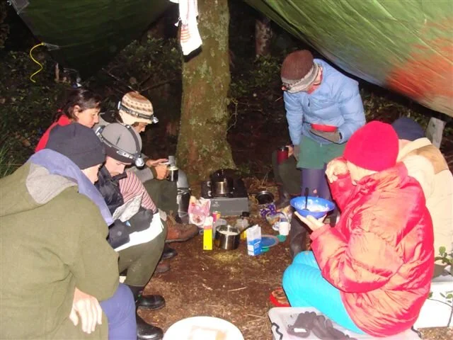
Place your bets please!
Regardless of what happened with Houdini, the other 11 birds had to be picked up and flown to the Flora at noon for the official release and contingency plans were being mooted about us staying in the camp another night or until we finally caught the little bugger. We all headed back up to where we were yesterday and fortunately Houdini was located lower down the hillside than he was yesterday. We spread out like a well trained military platoon and started to encircle him. (I could do with some suitable dramatic music here). Again, the scrub was so thick we couldn’t see each other a couple of meters away. Suddenly a call came up from just below us. "He’s heading up towards you" There was a rustling and I could see the grass moving heading straight towards me! He broke out of the grass almost at my feet and I plunged at him. I managed to grab a handful of feathers but did succeed in turning him straight towards Grant who has had a helluve lot more experience than I have at tackling these savage beasts. Again, the wonderful call of "I’ve got Him"! reverberated around the hills.

We headed back to camp like a conquering army and started getting everything ready to fly out and get our precious cargo to their new homes. Earl and I were flying back to the Flora with the kiwis, the rest of the DoC crew were going back out to the Aorere to pick their vehicle up and Bill, Andy and Leslie were going to walk out over a mountain range and onto the Heaphy track. (They were 24 hours late getting out, but that is another story)
We arrived at the Flora about 1pm and it was great to see a crowd gathered there for this fantastic occasion.

There were speeches by the local Iwi and Maryann Ewers the secretary and founding member of FoF who has worked tirelessly for 10 years for this moment. She justifiably looked so pleased and proud that what had started out as a dream so long ago, had now become a reality. The birds were then loaded into DoC vehicles and driven off to be placed in their new burrows, which it is hoped they will take an instant liking to and stay put.

I managed to get a last glimpse at Clawdia and Houdini before they were taken off and wished them well. I truly hope that they, in particular, like their new home as I’m sure, that any offspring of theirs would be a great foundation for any future generations..
I am so, so pleased that I was able in a small way to help this happen. I have met some incredible people and seen some amazing places over the past few months and have to admit that I am finding it very, very difficult to put it all behind me now and get on living a ‘normal’ life again.
I would also like to add that what a pleasure it has been to be associated with the Department of Conservation staff involved with this project. Their professionalism and dedication to their job is second to none . So long as people like Chris, Abbey, Earl, Sarah and Grant are around I feel that our endangered species might have a chance. Thank you all so much for giving me some of the most memorable moments of my life
So that’s it people. Done and dusted as they say. I don’t even know were to start thanking you all for your generosity and kindness. You have all certainly restored my faith in human nature.
Each and everyone of you should feel every bit as proud that this has happened as I do as I couldn’t have done what I did without your support
I will hopefully hear what these birds are up to over the next few months, so if anyone is interested, let me know and I will keep you up with the play.
Once again, thanks heaps for everything.
Good luck in whatever you may do and keep smiling!! Cheers.

Weekly Update No.25 - Tuesday 01/06/10
Just a quick note to bring you up to date with the latest on our new Flora residents. I went up into the area last week with Earl, (one of Motueka DoC staff) to see if they had all stayed put and settled in to their new abodes. We walked up to the Mt. Arthur hut (about an hours walk from the carpark), got the telemetry aerial out started scanning around to see if we could pick any beeps. Almost immediately we started getting a very strong signal from somewhere down the slope from the hut and on looking at our transmitter details, we saw it was our good mate Houdini!!

He was about 2-3k’s from where he had been released and we started scanning around for his mate Claudia, but after a good length of time couldn’t pick up any signal from her at all so headed off over the next ridge to try for some of the other birds. Again, we very soon picked up another signal, this from the female of another one of a pair. This time it was the male we couldn’t find. If he has done a bunk with Claudia, he’s one very brave chap!! Mind you, she’s a fine looking specimen!!

We headed back down towards the valley along a side ridge scanning along the way and picked the signals from a number of other birds down in the valley below.

We saw a good set of footprints in the mud along the way, but haven’t been able to work out if they belong to one of our Kiwis, or to one of the Wekas that also live up there.

By the time we reached the 4 wheel drive track that runs through the Flora Valley, we had located 10 out of the 12 birds, a very encouraging sign at this stage. Most of them had moved away from the areas they were released in but were still around. The plan was to get up there again soon, but it looks like the weather gods have other ideas. There was 100 mls of snow dumped up there last week and more forecast for today, so we will have to wait and see when someone can get up there again. The weekend before Earl and I went up, there was 150 mls of rain the weekend before which had a pretty dire effect on the road.

I guess if we don’t get a fine spell in the near future, not a lot will be able to be done until next spring.
I hope none of you mind, but I have put you on the FoF email newsletter list. This is a monthly publication and will have regular items on the Kiwis. If any of you don’t want to receive this, there is an unsubscribe option on the newsletter.
If I hear any other news about them in the next couple of weeks I will let you all know.
Take care and keep warm and dry !!